
Today was chilly with increasing clouds and temperatures topping out around 40 degrees. It certainly felt much cooler outside today than days prior with the increased cloudiness.
Tonight:
Sprinkles will evolve into a steady rain this evening and overnight. A few sleet pellets cannot be ruled out this evening. Temperatures will be steady in the mid 30s overnight. Generally .25″-.50″ of rain is expected.
Tomorrow:
Some departing showers are possible in the morning, but partly cloudy skies will follow for the afternoon. High temperatures will be near 50 degrees. Winds will pick up out of the northwest in the afternoon to around 10-15 mph. Winds may gust as high as 25-30 mph. The chance of rain in the early morning is around 50%.
Tomorrow Night:
Skies will be partly cloudy and temperatures will bottom out in the upper 20s. There will be a northwest wind around 10 mph with gusts up to 20 mph in the evening.
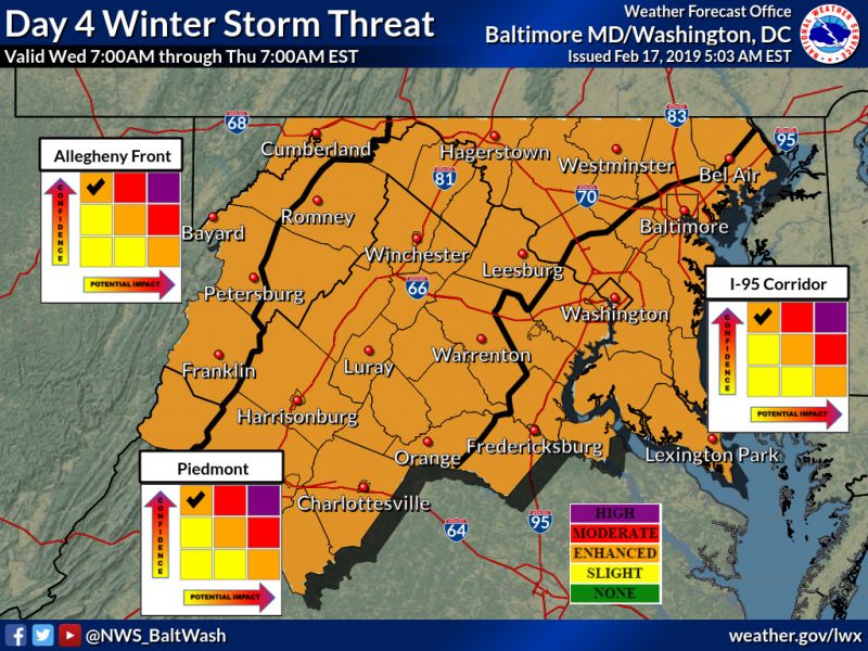
The National Weather Service in Sterling, VA has highlighted the area under an ‘enhanced’ risk for a winter storm threat for Wednesday. Image courtesy of www.weather.gov.
A Look Ahead:
Tuesday will be chilly and dry ahead of our next chance of wintry weather, which comes late Tuesday night into Wednesday. This very well could be the most significant winter storm of the semester so far. Like most other systems that have impacted the region lately, precipitation will be a mixed bag. Precipitation will likely start late Tuesday night as snow before a transition to sleet and freezing rain during the day on Wednesday. A transition to plain rain is likely by Wednesday night. The wintry precipitation and below freezing temperatures are more likely to hang around a bit longer for this event than those prior. This could offer some accumulating snow and ice accretion as temperatures hold at or below freezing for several hours. The speed of the transition from snow to a wintry mix to rain is still very uncertain, and this could make the difference between just another glancing blow or an impactful winter storm. As for classes Wednesday, cross your fingers as this could be the most legitimate chance thus far of having some classes cancelled.
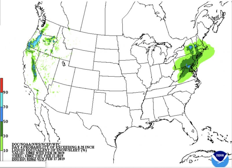
There is a 30-50% (moderate) chance for .25″ or greater of liquid equivalent precipitation in the form of sleet/snow for Wednesday. Image courtesy of noaa.gov.
Featured Image via pixabay.com