
Today almost felt like early Spring compared to the bitterly cold temperatures in the region the last several days. Highs topped out right around 50 degrees, which is above normal by about five degrees for this time of year. Most of the snow on the ground melted away with the partly cloudy skies and mild temperatures.
Tonight:
Temperatures will drop to the low 30s under partly cloudy skies. Some patchy fog is possible later this evening. Any wet surfaces may be a little slick as temperatures bottom out around freezing. Winds will be light and variable.
Tomorrow:
If you thought today was nice, tomorrow will be even better! Temperatures will rise to the mid 50s under mostly sunny skies after the morning fog dissipates. Winds will be light and variable.
Tomorrow Night:
Lows will not get anywhere near freezing, so for the first time in a long time, no slick spots are expected. Temperatures will only drop to around 40 degrees due to a light southeast wind and mostly cloudy skies. There is about a 20% chance of a shower after midnight.
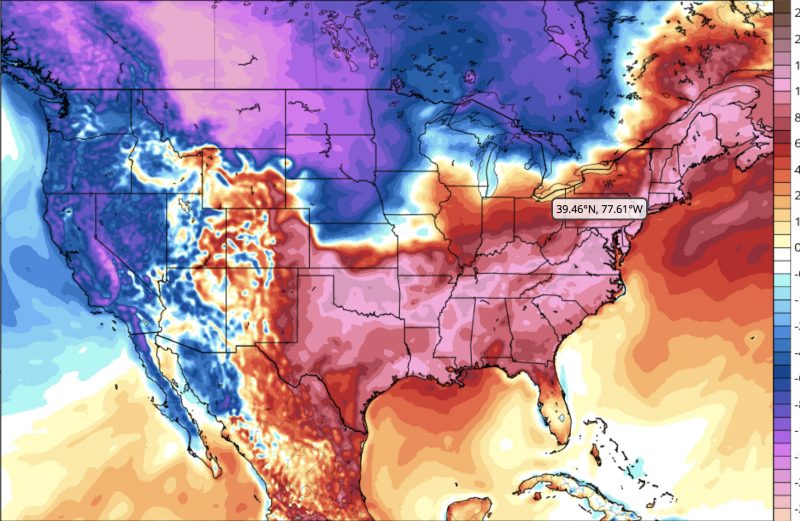
Temperatures Tuesday will be about 15 degrees above average. Image courtesy of tropicaltidbits.com
A Look Ahead:
Tuesday will be the warmest day of the week, and it will feel more like the end of March than the beginning of February with highs in the low 60s under mostly sunny skies. Some rain showers are possible Wednesday through Friday, so expect a wet second half of the week. A return to cooler temperatures looks likely for next weekend.

A warm front later this week will straddle the region bringing with it cloudy skies and some light rain. Image courtesy of weather.gov
Featured Image Courtesy of pixabay.com