Today was more or less an average end-of-Fall day for College Park. With a high of 44 degrees and little to no wind, conditions were unremarkable, especially relative to our weekend ahead. The skies were mostly cloudy throughout the day and while no rain was received in the area there still remains a chance for isolated showers later this evening.
One significant bit of weather news for today however, is that as of tonight the 2018 Atlantic Hurricane Season will draw to a conclusion. While hurricanes can still very well develop as has occurred before, lets keep our fingers crossed that one of the most destructive seasons ever recorded does indeed come to an end.
Tonight:
Continuing on with our forecast, this evening is expected to be similar to the conditions we saw during the day apart from a change in temperature. Skies will remain mostly cloudy, which will help to keep some of the heat energy we received during the day earth-bound. Even so, temperatures are still expected to drop down to 33 by tomorrow morning. These colder temperatures will be the result of the stationary front currently overhead transforming into a cold front. When this colder air wins its duel with the warmer air currently overhead, its move down south could also see the development of some isolated showers overnight. Bringing an umbrella and a jacket might be a good idea or a good winter coat for those folks who like keeping warm at all times, myself included.

Surface Weather Analysis Map for 1400 EST. Notice the Stationary Front overhead prior to the formation of a weak low pressure system and its associated cold front. Courtesy of the Weather Prediction Center.
Tomorrow (Saturday):
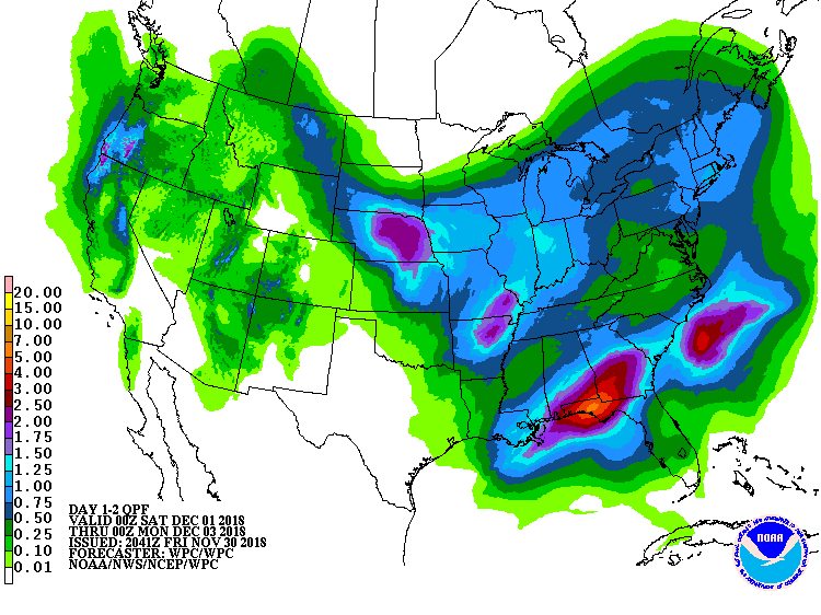
Unfortunately, tomorrow is looking like a repeat of our previous weekend in during which we saw rainy conditions for much of Saturday. A high of around 45 degrees is anticipated and the skies will once again be cloudy, if not mostly cloudy. Winds will also be light and variable at times. However, we are anticipating rain likely beginning sometime between 2 and 4 p.m. and wrapping up around 4 a.m. Sunday. Rainfall totals are expected to be 0.25 to 0.5 inches for College Park and areas farther south of here. However farther north of here totals may range from 0.5 to 0.75 inches. Either way, if you have any plans during the day you most definitely will want to bring a jacket for when the rain becomes steady during its peak.

Latest Quantitative Precipitation Forecast for the next two days. Courtesy of the Weather Prediction Center.
A Look Ahead:
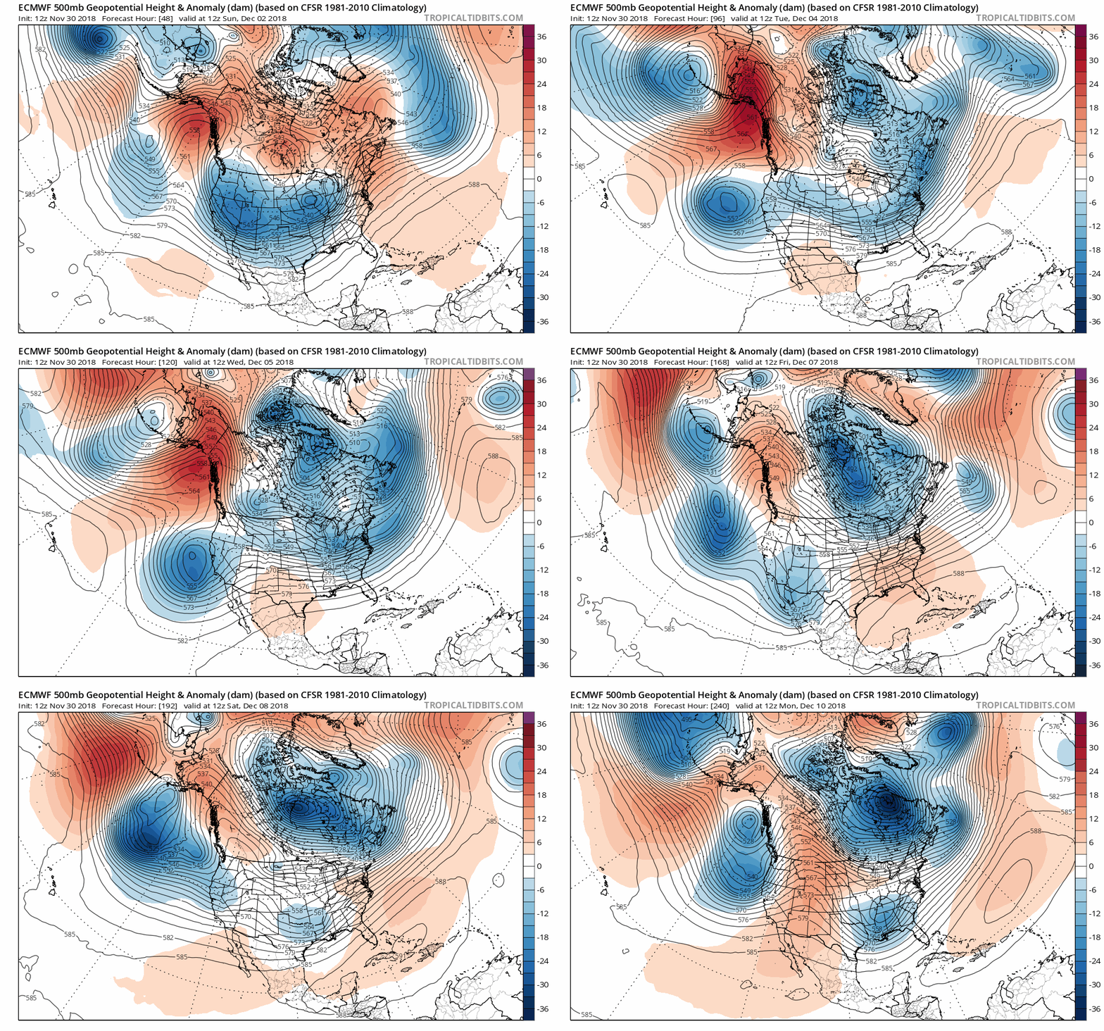
Now this is where the fun part of the forecast truly starts. Currently two of the more widely used global models, the GFS FV-3 and ECMWF, are forecasting for a large area of warm area to blanket Alaska through much of this week ahead. This might seem random but our atmosphere is not something that is limited to just any one region, nor are its effects limited to one region. Indeed, what occurs on an entirely opposite side of the planet has consequences everywhere else. This warm air over Alaska is one such example of how these “teleconnections” influence our weather.
Typically when warm air finds itself implanted over Alaska for more than a few days, the result for much of the country is that cold polar air moves further down into the Continental United States (CONUS) than would be typically expected. For those of you who follow the Washington Post, you may recall that a similar event occurred early this Fall and was one of the strongest warm air anomalies ever seen in Alaska. While this didn’t mean much in the way of weather for the CONUS at the time, such an event occurring now would produce the possibility of snow for the East Coast should any low pressure system or front make its way through the region. Should this warm air anomaly (or “blob” as the Capital Weather Gang calls it) hold up we may well see snow this week.
While it is entirely inappropriate to forecast for any potential snowfall totals at this time or even whether we will see a snow storm, recently the GFS-FV3 has trended toward this concept of a winter storm impacting the region around December 9th. However as was previously noted, any forecast that far out is much more error prone due to the chaotic nature of the atmosphere. The most recent run of the GFS-FV3 fully captures this, with it now showing less snowfall for the region but a snow storm none the less. So if you hear anyone refer to a chance of snow the week ahead remember to take it with a grain of salt and keep your eyes and ears open for the latest forecasts as we inch into the week. The closer we get, the better an idea we will have of how much if any snow we could receive.

Latest 500 MB Temperature Anomaly Prognostic Chart from the ECMWF. Note the warm air anomaly over Alaska and, its persistence through the week. Courtesy of Tropical Tidbits.
Featured Image courtesy of Sheri Kimbrough from Weather Picture of the Day
