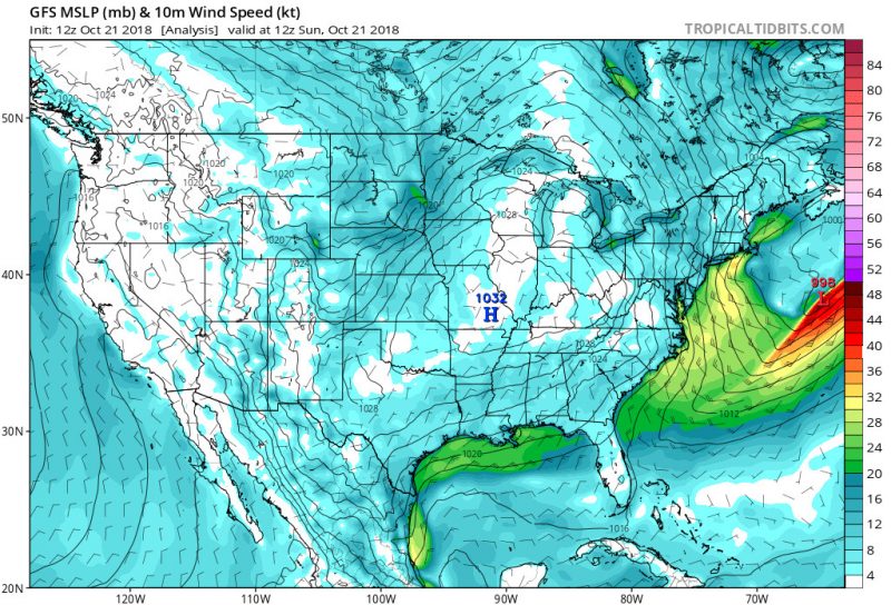
Happy Sunday Terps! Tomorrow marks one month since the Fall equinox, and temperatures are finally starting to become consistently seasonable. Temperatures will lean more towards the warmer side early on in the week with the departure of a high pressure system. However, a cold front moving through on Tuesday will restrict high temperatures throughout the rest of the week to the low-to-mid 50s. A lack of moisture in the atmosphere associated with this cold front will prevent rain from disrupting your commute to class on Tuesday.
Tonight (Sunday):
High pressure moving into the area will keep winds calm and temperatures cold. Lows should drop down into the mid-30s overnight. There is a frost advisory for our area overnight due to these low temperatures.
Tomorrow (Monday):
Temperatures should warm up a bit as highs reach 60 degrees. You can expect clear skies with a few passing clouds in the afternoon. Sustained winds shouldn’t exceed 5 mph. Overall, it will be a nice fall day on campus. Overnight, you can expect clear skies with temperatures dropping down into the lower 40s.
Looking Ahead:
The timing of the cold front passage will largely influence daytime highs for Tuesday; model output statistics currently project temperatures to reach the upper 60s. Conditions will cool off rather quickly that night, and morning lows on Wednesday will drop into the lower 40s. Precipitation shouldn’t be an issue with this cold front passage as the amount of moisture in the atmosphere is only enough to create shallow layered clouds.

GFS model mean sea-level pressure and 10 meter winds (via Tropical Tidbits).
Featured image via Pixabay.com
