
Summer conditions have decided to take a much needed break at the onset of the fall season. Relatively cool temperatures combined with large amounts of rainfall have created a fairly chilly environment over the past couple of days. Weather conditions will be very similar to start the week. However, hot weather will soon make a forceful return as temperatures should warm up considerably on Tuesday and Wednesday.
Tonight (Sunday):
Tonight we will see overcast skies with temperatures hovering around 60 degrees. Brief periods of light rain are possible throughout the night. Light winds will move in from the northeast.
Tomorrow (Monday):
Continue to expect dreary weather with periodic showers occurring throughout the day and cooler temperatures that only reach the mid-60s. Light winds should head in from the east.
Tomorrow Night:
Light rain is probable throughout much of the night. Expect temperatures to linger in the mid-60s while weak winds head in from the southeast.
A Look Ahead:
After a very cold start to the week, warm weather will make an abrupt return on Tuesday as highs are expected to elevate to near 80 degrees. Expect further warming on Wednesday as highs may settle well into the 80s. However, showers are still probable early on Tuesday along with overcast skies throughout the day. Things have an opportunity to clear up a little on Wednesday before a chance of thunderstorms later on in the day.
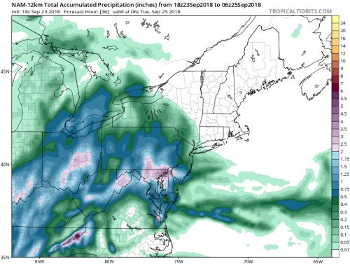
NAM model’s projection for total accumulated precipitation from 9/23 2pm to 9/25 2am (Picture by Tropical Tidbits).