
With the return of cooler weather and a departure from the wonderful 60 and 70 degree weather of the weekend, winter still seems hesitant to leave just yet. With a current temperature around 50 degrees and cloudy skies throughout the day, it seems we still have some more time ahead of us before spring fully arrives. Early this afternoon, the region saw the arrival of a drizzling rain in addition to the blanket of clouds that has been omnipresent above us today. Of course the conditions we are experiencing here today are much calmer and fortunate than those expected in the Ohio River Valley down to the Mid South today, with an active severe weather threat currently developing in that region.
Through Tonight:
While a low pressure system is forecast to progress toward the northeast tonight, it should have no additional impact on the region, with the warm front of that system being responsible for today’s dreary weather and the continuation of it into tonight. Winds will likely remain the same, near 10 miles per hour with skies mostly cloudy and offering a 20% chance of a drizzling rain. Fog may also be possible tonight after 8 PM, although it will likely be patchy and not a widespread event. The temperature will prove to be more interesting however, with temperatures actually forecast to continue increasing and reach a high of 57 degrees….at midnight tonight rather than in the late afternoon as is typically seen.
Tomorrow (Wednesday):
Tomorrow will bring weather more consistent with spring time, as thunderstorms are forecast to move though the region, and keeping with the recent spree of broken trends, these thunderstorms will likely arrive in the morning. A high of 68 degrees is expected tomorrow before temperatures plummet down (surprise surprise) to a frigid 36 degrees overnight as the cold front sweeps the region, setting off thunderstorms around 11AM to 2 PM. These thunderstorms should not present much in the way of severe activity, but Wednesday’s primary concern is wind, (so much so that a Wind Advisory was issued between 10 AM to 7 PM) with speeds expected between 16 and 24 mph with gusts up to 40 mph. About a tenth to a quarter of an inch of rain can be expected from these storms as well.
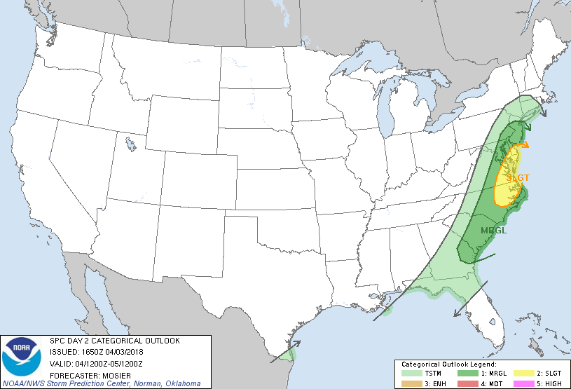
A slight risk is forecasted for the Mid-Atlantic Region (Source: Storm Prediction Center/NWS)
The Week Ahead:
Looking forward, the current trend of an increase in temperatures more akin to spring followed by a decrease back to temperatures more associated with winter is expected to continue. In fact, some models are currently anticipating a snow event on Saturday, much to the chagrin of those of us who are waiting for spring and weather forecasters alike, with the Monday snow still fresh in our minds.
However, conditions at this time to seem to be much more promising for the possibility of snow, with a high ranging in the upper 40s and a low ranging from the low 30s to upper 20s. In fact, the European model currently supports temperatures easily being freezing up until Saturday evening, making it likely the region could see solid snow accumulation. While snow totals are currently out of the question given the uncertainty 4 days out, it will definitely be something to keep an eye on.
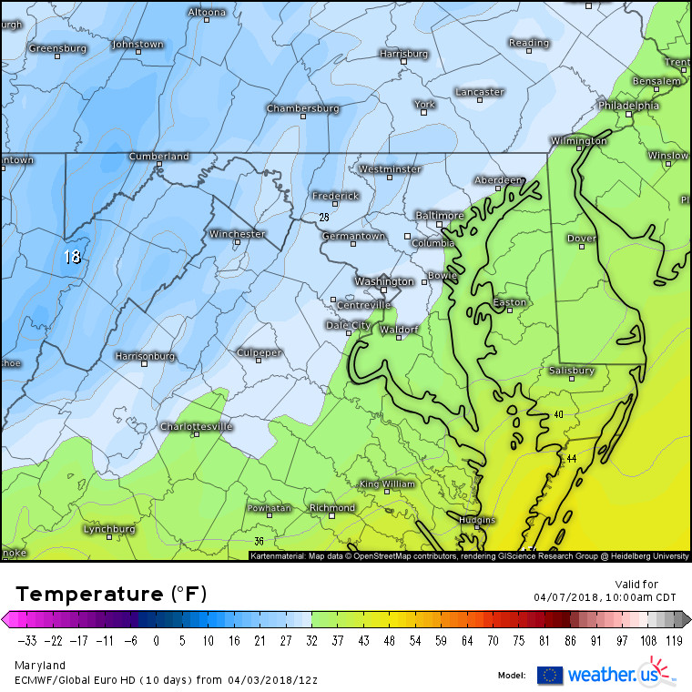
Latest Euro model run depicting subfreezing temperatures at the surface. (Source: Weather.US Euro Model Charts)
Featured photo courtesy of Pixabay.