
Today was another cool and windy day, but remained mostly sunny. Another possible Nor’easter could bring frozen precipitation to the DMV and the Northeast early next week. Don’t forget to move your clocks an hour forward on Sunday!
Through Tonight:
Partly to mostly clear skies will continue tonight with west winds slowly dying down. Temperatures will still be brisk and fall into upper 20s again. Any evening plans will still need a coat as winds will be 6-13 mph with gusts up to 20 mph.
Tomorrow (Saturday):
Mostly sunny skies continue as temperatures will rise into the upper 40s. The biggest difference will be the much weaker winds at 6-9 mph from the west. Saturday evening will continue to remain mostly clear, allowing temperatures to fall again to the upper 20s. Winds will shift from the North at 3-6 mph.
Sunday:
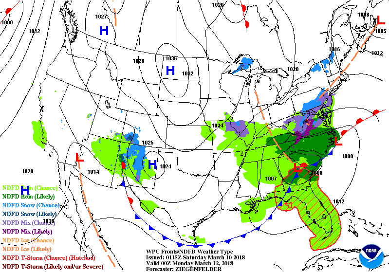
Sunday will start mostly Sunny, but clouds will start to develop throughout the day. Scattered showers are possible in the afternoon and evening. During late evening as temperature fall to near freezing, snow will start to mix in. The models right now are trending to a weaker nor’easter, but the forecast is very uncertain. Effects right now look limited for the DMV area with more effects to the Mid-Atlantic Coast and the saturated Southern Maryland. Highs will rise to mid 40s. Winds remain no where near last Friday’s wind storm.
Early Next Week:
Monday morning and early afternoon maybe the most likely time for widespread precipitation that will be either rain or a mix depending on warm temperatures are. Temperatures are trending below normal for next week, but more sun throughout the week barring Monday. Stay tune for updates on this storm through the Weekend.
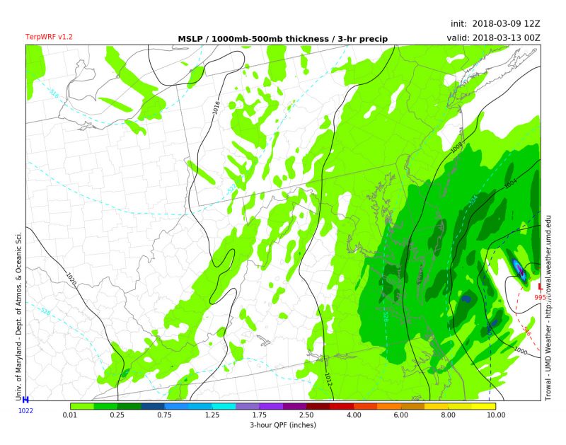
This image from TerpWRF shows the possible nor’easter couple hundred miles off coast around noon on Monday. Though some models are showing the storm moving further away from the coast.