
This cloudy Thursday is pleasant compared to what is eyeing the DMV this evening and Friday. Highs reached into the low 50s today with a calm wind. Luckily, most of the rain stayed very light keeping us terps nice and dry.
Through Tonight:
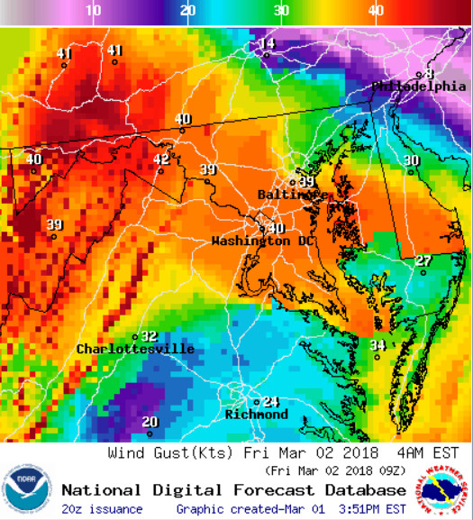
Heavier rain showers will move into the area just in time for rush hour. College Park could see up to a quarter of an inch of rain before midnight. Things will get messy once the clock strikes 12. A potent low pressure system is set to blast through the Mid-Atlantic and Northeast, strengthening as it moves off the coast. Not only will we be staring down the barrel of some scattered snow and rain showers but the winds will be the thing to worry about. This is not your usual wind event. The gusty conditions will begin late tonight. Winds will stay sustained between 15 to 20 mph with gusts as high as 50 mph. This strong storm system has prompted a High Wind Warning stretching all across the state of Maryland.
Tomorrow (Friday):
The high wind event will continue throughout the entirety of Friday. Move those outdoor events inside as winds will gust close to the 65 mph mark. If you’re out driving around be very careful on the roadways as high profile vehicles will have trouble maneuvering down the road. The High Wind Warning will stay in effect throughout the day. If you must venture outdoors for class or work, leave some extra time for travel as the windy conditions will cause traffic trouble. The mercury will only make it into the mid-40s on Friday with wind chills in the 30s. Rain and snow will mix in throughout the morning before the wind dries out the DMV.
The dangerous wind will stick around through early Saturday and even into Sunday before the potent system moves further offshore.

Stay up to date with all that is UMD Weather by following our Twitter page and liking us on Facebook! UMD Weather Forecasters will be putting out updates as the system moves through.