
Today brought the return of bright and sunny weather, bringing the conclusion of a rainy and dreary weekend. With a peak temperature of 57 degrees this afternoon in College Park, temperatures have remained well within seasonal averages as compared to the previous weeks unseasonable temperatures. Going forward however, we will likely see the return of rain as the high pressure system currently over the mid Atlantic region moves out to sea.
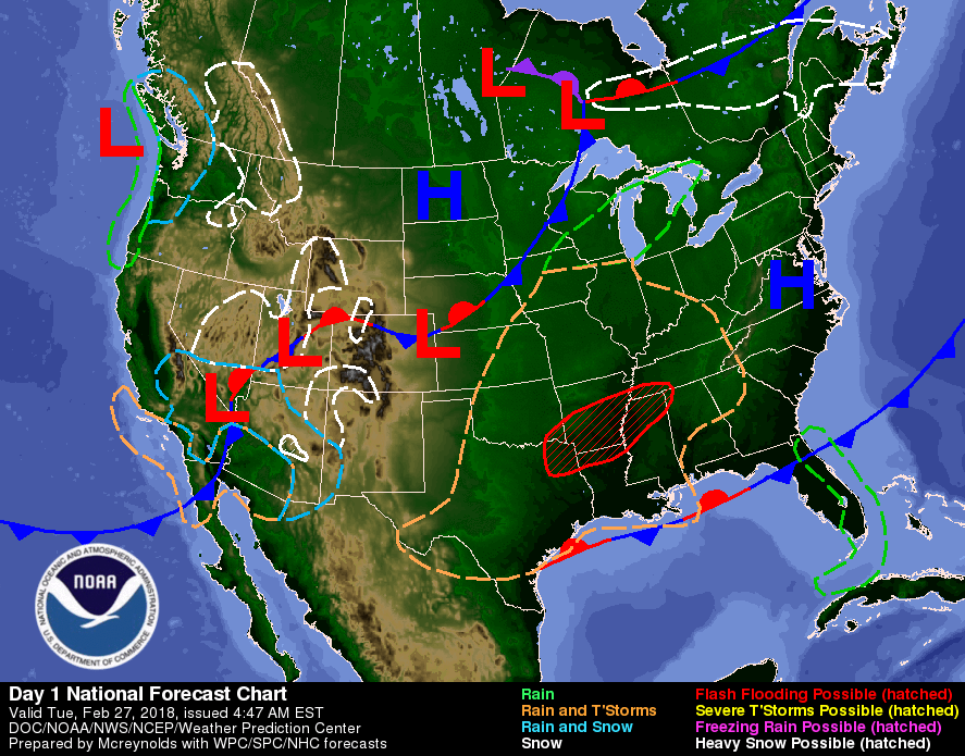
High pressure system continues to dominate the region before beginning its exit tomorrow (via WPC/NOAA).
Through Tonight:
Uneventful weather is expected tonight, and temperatures will drop down to 39 degrees. Winds will be light and variable around 3 to 7 miles per hour. Chances of precipitation are near zero thanks again to the system overhead, making tonight warmer than yesterday, although not quite warm enough to turn the heat off just yet.
Tomorrow (Wednesday):
With the high pressure system will start its journey toward the Atlantic, temperatures will remain within the seasonal average, with an expected high of 59 degrees and a low of 45 degrees. Winds however may be blustery at times ranging from 6 to 12 miles per hour and with gusts possible up to 21 miles per hour. Tomorrow will also be a transition to mostly cloudy skies. Rain is out of the question, but the potentially gusty winds may require a light windbreaker or plain old sweatshirt.
The week ahead:
With the high pressure system expected to move out to the Atlantic, it’s expected that the trailing low pressure system will embrace us with wind and rain from Thursday into Friday, with greatest impacts on Thursday night. The latest GEFS model run shows rain accumulation of 0.3 to 0.4 inches through Friday morning.
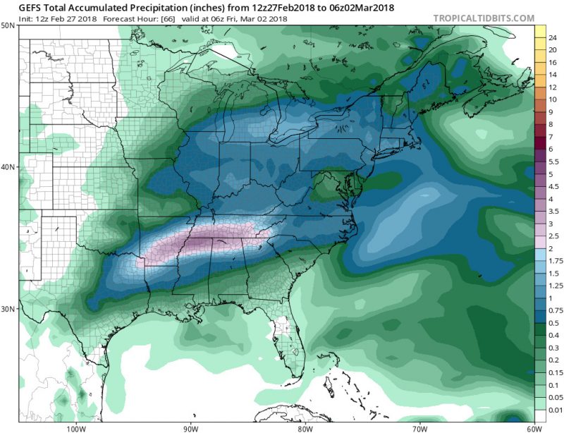
GEFS model run showing most of the area receiving rainfall between 0.3 – 0.5 inches on Thursday night (via TropicalTidbits).