
Temperatures warmed up nicely today after a cold morning, aided by a warm front passing by and southerly winds to bring warmer air into the region. For the weekend, be prepared for mild and wet weather.
Through Tonight:
Clouds will fill the sky tonight as unsettled weather approaches from the south and west. Low temperatures will fall into the mid-30s, with winds from the south at 5-8 mph.
Tomorrow (Saturday):
Showers will start around mid-morning and will continue throughout the day with increasing intensity. Highs will reach the low-5os as warm air continues to flow in from the south. Winds will be out of the south at 5-7 mph. Saturday evening remains mild and wet with lows only falling into the upper 40s. Rainfall amounts on Saturday will reach at least a half an inch to an inch.
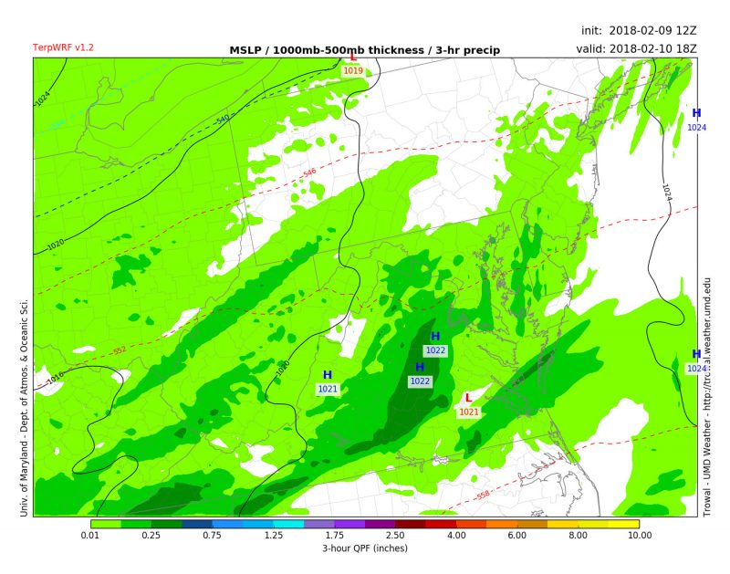
This image from TerpWRF shows widespread rain across the DMV by 1 p.m. on Saturday.
Sunday:
Rain will continue throughout the day becoming lighter and more scattered by the evening. Highs will be even warmer and reach the low 60s. Winds will be out of the southwest at 6-9 mph.

This image from TerpWRF shows the 2 meter temperatures for the DMV area reaching the 60s on Sunday afternoon.
Sunday evening, the showers will continue to break up with lows remaining mild in the mid-40s. Winds will shift from the northwest at 7-9 mph. Total rainfall amounts will reach upwards of 2 inches and with a relatively frozen ground, isolated flooding is also expected. This weekend’s rain will be much needed and a great help the area’s growing drought.
Looking Ahead:
The beginning of next week is looking cooler than the weekend, but temperatures will remain above average for the area. More chances of rain are also in the forecast and will continue to push back the drought.