
Due to the overnight cold front, today’s high temperature clocked in at 42 degrees around midnight, slightly colder than the 45 degrees average for today. The sun didn’t put in much effort to warm us, even though there were only a few clouds. And if it wasn’t already cold enough, the wind helped make it feel even colder.
Through Tonight:
The cold, Canadian air mass we’re under sticks around tonight, helping temperatures plummet well below freezing down to 17 degrees. With sunset still 30 minutes before 6 pm, the night has plenty of time to cool down. And while the winds aren’t as intense as they were earlier today, they’ll still help cool it down even further. These are some of the coldest temperatures we’ve seen in a while, so make sure you bundle up if you’re going outside tonight.
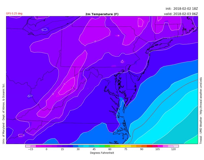
Temperatures drop well below freezing overnight, even reaching down to 0 degrees in the Appalachians. (Via Trowal)
Tomorrow (Saturday):
The start of the weekend acts similarly to today. With temperatures only reaching somewhat above freezing, winter is showing it plans to stick around. Clear skies and some sun might help alleviate some of the cold, but light winds from the south-southwest might mitigate that heating out. While it’s very cold right now, we’re more than halfway through winter at this point, so we should start to see some warming up in the coming weeks.
Stay tuned to our twitter for the potential system making its way towards the east coast for Superbowl Sunday.