
Hopefully you enjoyed the warm weather while you could! With the semester slowly settling in, unfortunately the forecast is trending colder and colder. Tomorrow will be the last bit of this mid-winter thaw before temperatures return to climatology.
Through Tonight:
Luckily, the current temperatures right now will be close to the lowest they dip tonight. The overnight low will be around 32 degrees with winds around 8-10 mph. Skies will remain mostly cloudy which will help to keep temperatures above freezing.
Tomorrow (Thursday):
In the morning, temperatures will be near freezing with mostly cloudy skies and winds coming out of the southwest around 5 mph. As the day continues, more clouds will roll into our area posing a threat for some evening showers. The chance for rain is relatively low, as most of the rain will be entering the area on Friday. The high for the day will be right around 50 degrees.
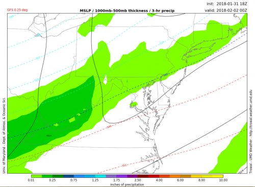
The GFS model showing rain entering the area around 8pm tomorrow. (via Trowal)