For those of you who like summer, the warm temperatures common in summer have been sticking around well into fall. Temperatures today reached into the low 80s, with some humidity and light wind. Moderate clouds made it a beautiful day for people who like the heat, but if you’re like me, it was just a bit too hot. If you’re waiting for it to cool down, you’ll have to wait for next week, as these temperatures are set to stick around for the next few days. However, if you look closely, you can see some leaves starting to change colors.
Through Tonight:
Temperatures tonight drop only into the low 60s, as opposed to the average mid-40s seen at night this time of year. Clouds from a front to the far north will cover the sky at night. Light, southwest winds, and cool temperatures set up for what could be a nice evening.
Tomorrow (Friday):
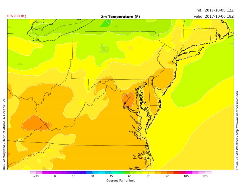
The last day of the work week is very similar to today. Patchy fog in the morning gives way to partly cloudy skies throughout the day. Temperatures during the day will reach up into the mid-80s, much more like late August or early September as opposed to early October. The abnormally warm weather will continue into the weekend, where some clouds will clear out.

Temperatures in the DC area reach into the mid-80s during the hottest part of the day. (GFS temperatures for Friday afternoon, via Trowal).
Tropical Outlook:
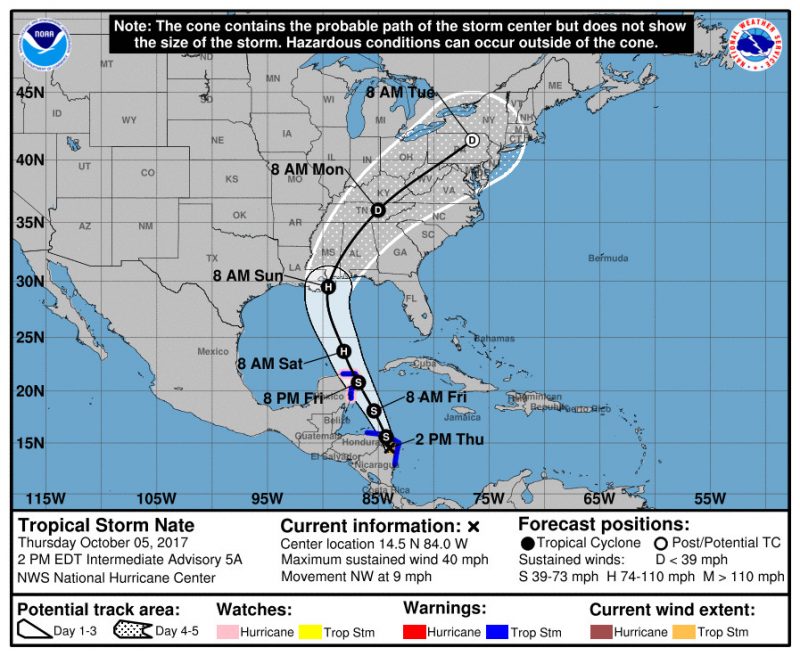
Even with the incredibly active season we’ve had, hurricane season is still going strong. Not ending until November 30th, we still have well over a month for more potential hurricanes. Speaking of potential hurricanes, Tropical Storm Nate has formed off the coast of Nicaragua. While still a ways out, Nate could have an impact on us as a post-tropical storm sometime next week. It’s currently forecasted to make landfall as a hurricane in Louisiana Sunday morning, but a lot can change between now and then.

Tropical Storm Nate has a projected path that makes landfall as a hurricane and reaches the DC area as a post-tropical storm. For more on hurricanes, visit the National Hurricane Center’s website.
Featured image via Shutterstock
