
A ridge associated with a high pressure system has been bringing fantastic weather for our region with sunny and partly cloudy skies. Warm temperatures with highs in the mid 80s will continue for the next few days before the high pressure system scoots out of our area and a trough takes charge with cooler temperatures. So turn off the TV and layoff the homework to enjoy this beautiful summer weather while it still lasts.
Through Tonight:
Lows tonight will dip into the mid-to-upper 60s with partly cloudy skies. Light winds from the northeast due to Hurricane Maria’s influence will complement this mild summer-like night. Winter is coming and therefore, the sun will set earlier than a typical summer day at approximately 6:58 pm EST.
Tomorrow (Wednesday):
Almost identical to today, gorgeous summer-like weather will continue into tomorrow with slightly higher temperatures floating around the mid 80s for our region. Light winds from the northeast will persist as Hurricane Maria continues to slowly churn north.
Tropics:
To the east of the Carolinas, Hurricane Maria, soon to be a tropical storm, is slowly moving north into colder waters. Tropical Storm Warnings for the Outer Banks of North Carolina are in effect as the outer rain bands of Maria will brush those beaches, with rain totals maxing out around 2 inches in some spots. However, Maria will not impact the Mid Atlantic states as a cold front will sweep Maria to sea in the upcoming days. Apart from dangerous rip currents at the beach, Maria is not expected to impact our area.
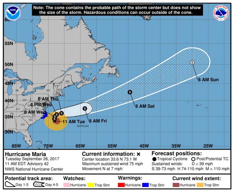
Maria’s track out to sea after passing by North Carolina. (via NHC)
Featured image via Pixabay.