
The calendar might say September, but it feels more like July! Today’s high temperature reached all the way up to around 90, while the average high for today is 76 degrees. This warmer than average and summer-like weather will continue through mid-week.
Through Tonight:
Another mild night will be in store for Maryland. It’d be great evening for a stroll or a meal outdoors. Low temperatures will dip into the upper 60s with partly cloudy skies. Winds will be out of the east at 5-10 mph.
Tomorrow (Tuesday):
Cloud cover will increase on Tuesday and provide slightly cooler temperatures. Highs will still reach the low 80s and dew points in the 60s will make it feel like summer. Winds will be out of the northeast at 5-10 mph. The evening will be very similar to Monday’s with temperatures only dropping into the upper 60s, but with mostly cloudy skies.
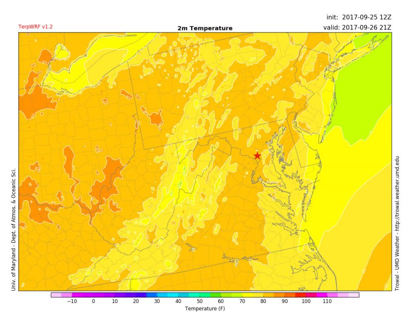
TerpWRF forecasted temperatures at 5 pm Tuesday. Red star depicts the University of Maryland. (via Trowal)
Tropical Update:
Remember Maria? The storm that ravaged Puerto Rico and other Caribbean islands is still churning in the Atlantic. It has even prompted tropical storm warnings for the Outer Banks of North Carolina. High surf and rip-tides are the main concern through the end of the week as Maria passes off the coast of the mid-Atlantic. It is expected that the College Park region will experience no impacts from Maria except an increase in cloud cover.

Forecast track and tropical storm warnings for Maria valid 5 pm. (via NHC)
Featured image via the author.