
While this is technically the last day of summer, it sure doesn’t feel like it’s going anywhere. Midday temperatures reached into the mid-80s, with light winds and partly cloudy skies. This warm weather is due to the continued influence of Tropical Storm Jose, which may impact New England more directly in the coming days. Regardless, it’s a great day to go outside and enjoy the weather.
Through Tonight:
Tonight will be similar to the previous few nights, just slightly cooler. Partly cloudy skies tonight will cause temperatures to fall into the low 60s, with light winds from the north.
Tomorrow (Friday 9/22):
The forecast for tomorrow is very similar to the conditions we experienced today. Highs in the mid-80s, accompanied by mostly sunny skies and light winds from the north. It will be a great start to the weekend.
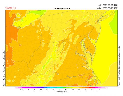
The UMD model TerpWRF predicts temperatures reaching into the mid to upper 80s for tomorrow afternoon. (via Trowal)
Tropical Outlook:
Hurricane Maria is the storm that has everyone’s attention. After causing catastrophic damage in Puerto Rico and other nearby islands, Maria weakened to a Category 2, but has restrengthened back to a major hurricane. While the Dominican Republic and Turks and Caicos are still in danger, the continental United States currently looks to be dodging the devastating influence of Maria. The storm forecast currently tracks out into the Atlantic, and landfall in the states seems unlikely at this time. For more official hurricane forecasts, go to the National Hurricane Center.
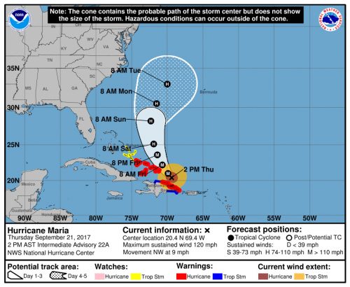
While still dangerous to the nearby islands, Maria seems unlikely to have a significant impact on the continental United States. (via NHC)