
Welcome back! Classes have officially started and the fall semester of 2017 has officially begun. Temperatures have been feeling like fall and will continue to do so as a tropical system spins along the coast during the middle of this week.

Forecast track for “Potential Tropical Cyclone Ten” as of 5 p.m. Would be named Irma if it strengthens. Biggest impacts will be felt along the Carolina Coast and Delmarva peninsula. (Via NHC)
Through Tonight:
Clouds hang around overnight and keep temperatures in the low 60s. Rain moving in from the south may reach the DC area after midnight, but will remain light. Winds will be out of the northeast at 5-10 mph.
Tomorrow (Tuesday):
Windy, cool, and wet at times will describe the second day of classes. A weak tropical system will throw clouds and showers towards campus. Most of the precipitation will be centered toward the east, but upwards of a quarter of an inch of rain is possible. High temperatures will only reach the low 70s and with the stiff breeze some light jackets might actually be necessary. Winds will be out of the northeast at 15-20 mph, gusting as high as 25 mph.
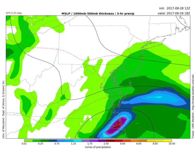
GFS showing rain towards the eastern shore and showers inland. Valid 2 PM Tuesday. (Via Trowal)
Wednesday:
A better day to spend time outdoors! Showers move out in the morning, but clouds remain for most of Wednesday. High temperatures will reach a little higher into the upper 70s. Winds will calm down to 5-10 mph out of the north.

GFS model showing comfortable temperatures for Wednesday. (Via Trowal)
Be sure to follow UMD Weather on Facebook and Twitter throughout the semester and get the latest weather information.