
The cool and damp pattern that started the month of May has finally exited and will be replaced by summer heat this week. A ridge of high pressure will move across the area Tuesday and settle off the coast. This will cause winds to shift and usher in warm air from the south. The hottest days appear to be Wednesday, Thursday and Friday. The first heat wave of the season will occur if high temperatures are able to hit 90 degrees on those three consecutive days.
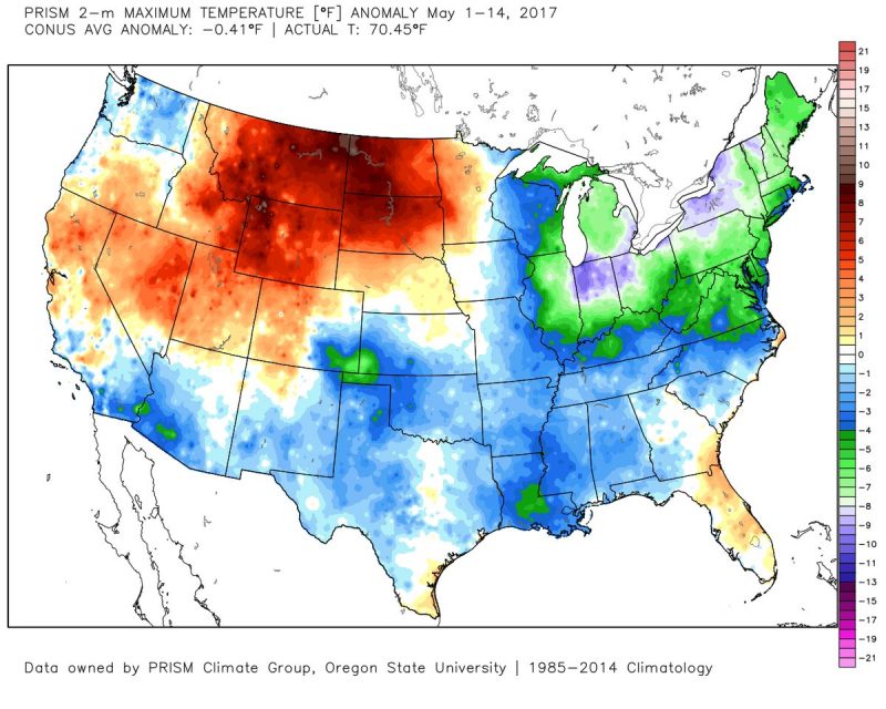
The first half of May had below average temps across the Mid-Atlantic and Northeast. (Via Ryan Maue)
Monday Night
Still breezy and cool this evening as dry air continues to dominate the area. Skies will be crystal clear and low temperatures will dip into the low 50s. Winds will be out of the northwest at 10-15 mph, gusting to 25 mph.
Tuesday
Another step towards summer as highs attempt to reach 80 degrees. Winds also die down to 5-10 mph after shifting to the southwest in the afternoon. Skies also remain sunny allowing grass and other plants to explode with life.
Wednesday and Beyond
Break out the flip flops, tank tops, and yes . . . deodorant. It will get quite sweaty Wednesday as high temperatures reach the low 90s. This will remain the case on Thursday as well. Skies will be clear, so don’t expect to much much of a break from clouds. Air conditioning will also be a must as overnight temperatures stay fairly warm in the 70s. Friday appears to be slightly cooler with highs reaching at least the upper 80s. This is due to the possibility of thunderstorms and more cloud-cover as the afternoon progresses. The weekend looks perfect, at the moment, with even cooler temperatures and dry conditions.
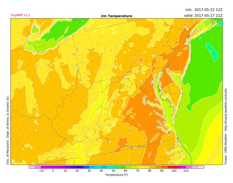
TerpWRF showing upper 80s at 4 pm Wednesday after a hot afternoon. (Via Trowal)
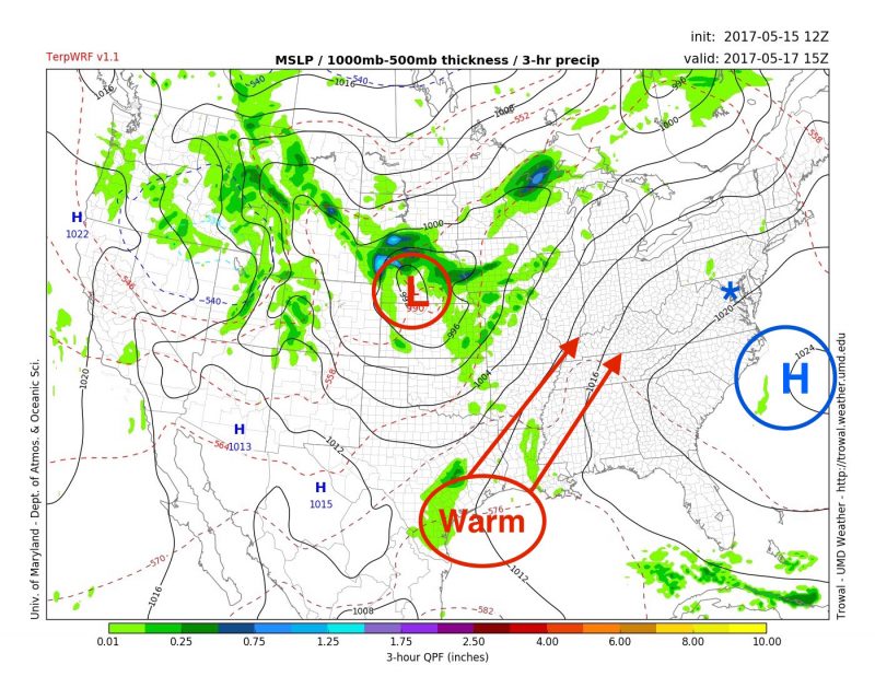
Overall pattern showing a High off the coast + Low in the middle of the country = warm southerly winds headed for Maryland.