
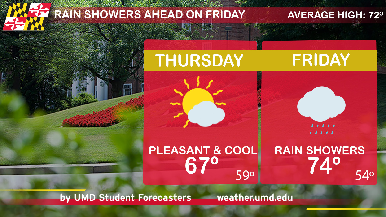
I hope you gave your AC a break and cracked a few windows open. Today was noticeably cooler (and far less humid) than previous days, but it was still a nice/pleasant day. Fair skies filled with sunshine and chilly conditions have trended on the middle day of the week. Winds have transitioned to a northwesterly flow. With colder temperatures northwest of Maryland, breezy winds will continue to bring cooler air to the DMV over the next few days. An approaching low-pressure system will push heavy rain showers in the area by late Thursday night/Friday morning.
Through Tonight: If you have plans tonight, then grab a jacket. Mostly clear skies will allow temperatures to drop to the mid-to-upper 40’s (upper 40’s near the District and cooler in the suburbs). After sunset, winds will diminish and vary in direction overnight.
Tomorrow (Thursday): Mostly cloudy skies mixed with chilly winds make up the overall pattern for Thursday. 8-13 mph southeast winds will make it feel slightly warmer (with increasing dewpoints). Gusty at times. Temperatures should push to the mid-to-upper 60’s with an increasing chance of late night rain showers. As far as timing goes, the earliest rain showers should move in around the 10-11pm time frame. Anticipate heavier bands of rain on Friday morning. Pack an umbrella and wear a raincoat!
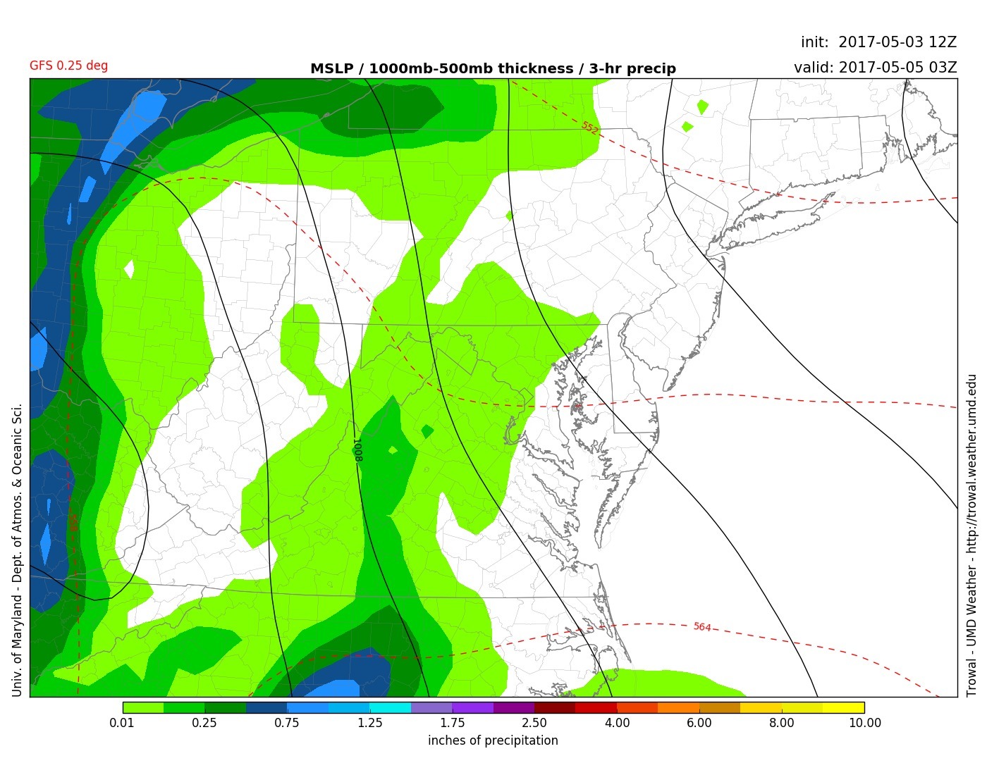
12Z GFS model displays rain showers in the DMV area on Thursday night (around 10-11pm). Heavier showers will move in by Friday morning (UMD TROWAL)