
A stubborn coastal low-pressure system has been the blame for continuous rounds of steady/widespread rain showers and dreary overcast skies today. Extensive cloud cover has blocked sunshine and limited high temperatures to around 60 in the District. As the coastal low gradually tracks along the Mid-Atlantic coast, light to moderate rain showers will continue to push northwest through the DMV area. By Wednesday, a slight warm-up will be the prelude to a weekend surprise.
Through Tonight: Occasional/spotty rain showers will persist through the remainder of the evening until around 5 pm. The evening commute should be mostly dry through 8 pm. Keep an eye out for slick spots on roadways. Later tonight, light drizzle and isolated showers will redevelop. Winds should diminish to a northerly 7 to 10 mph wind flow under mainly cloudy skies. Low temperatures will settle around the middle 50’s.
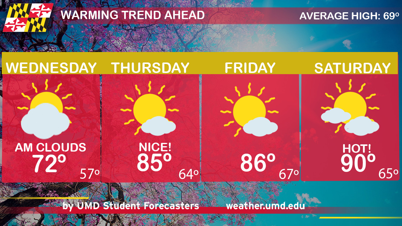
Tomorrow (Wednesday): We begin to dry out and welcome warm sunshine! As the storm moves north, winds will transition to a southwest breeze and push temperatures to the middle 70’s. There remains a slight chance for a lingering shower on Wednesday morning. You can ditch your umbrella after 7 am and enjoy a nice warming trend.
Looking Ahead to Maryland Day (Saturday): Did someone say it will feel like SUMMER this weekend? Well, get ready! A high-pressure ridge will build over the eastern United States and produce dry/hot unseasonably warm temperatures. On Maryland Day, dress for 90-degree weather (t-shirts and sandals) and pack a few cold water bottles.
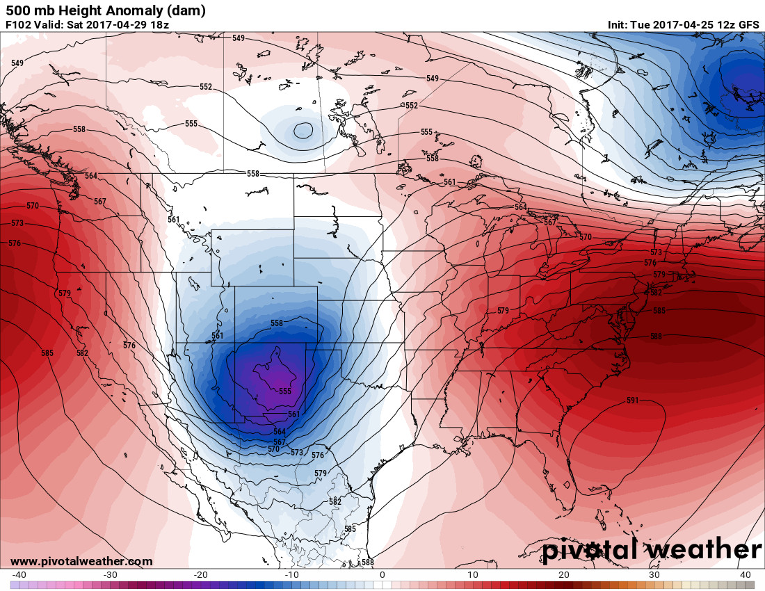
500mb Height Anomaly (dam) displaying a high pressure ridge over the Mid-Atlantic region. This will create above normal temperatures for this Saturday (Courtesy: Pivotal Weather)
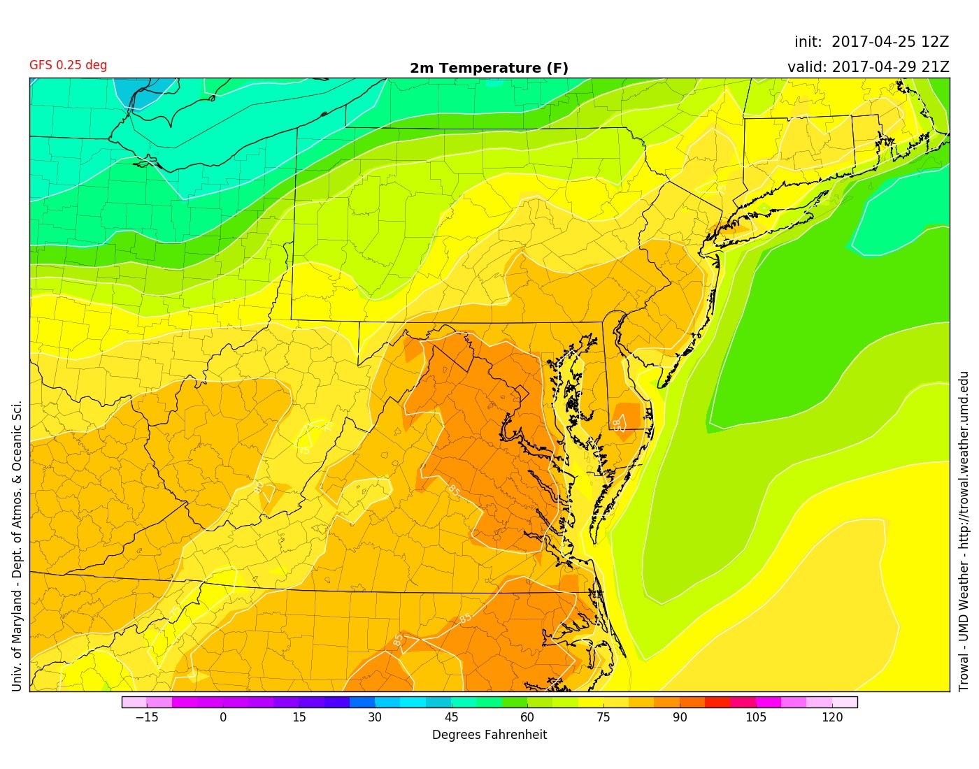
GFS displays 85-90 degree high temperatures for Saturday around 5 pm (Via UMD TROWAL)