
Once our system responsible for yesterday’s winter storm pulled out of the DMV region, we were left with biting, gusty winds and unseasonable cold for mid-March. Today’s temperature struggled to get out of the 20’s in College Park with a high of 31F. D.C set a record for the lowest high temperature this late into winter since the 1940s (when records started). That, coupled with strong winds out of the northwest, made for a miserable walk across campus today. Also, overnight low temperature’s allowed for a massive refreeze that made sidewalks quite slippery and hazardous through the day. This will be the case again tonight.
Through Tonight:
Brace yourself and bundle up as temperatures take another nosedive into teens and low 20’s overnight. Clear to partly cloud skies will help the temperatures drop quickly. Winds will continue out of the west and northwest at 10 to 15 mph, with some gusts reaching 20 mph. The melted snow and ice will easily refreeze overnight, posing a walking and driving hazard for your morning commute.
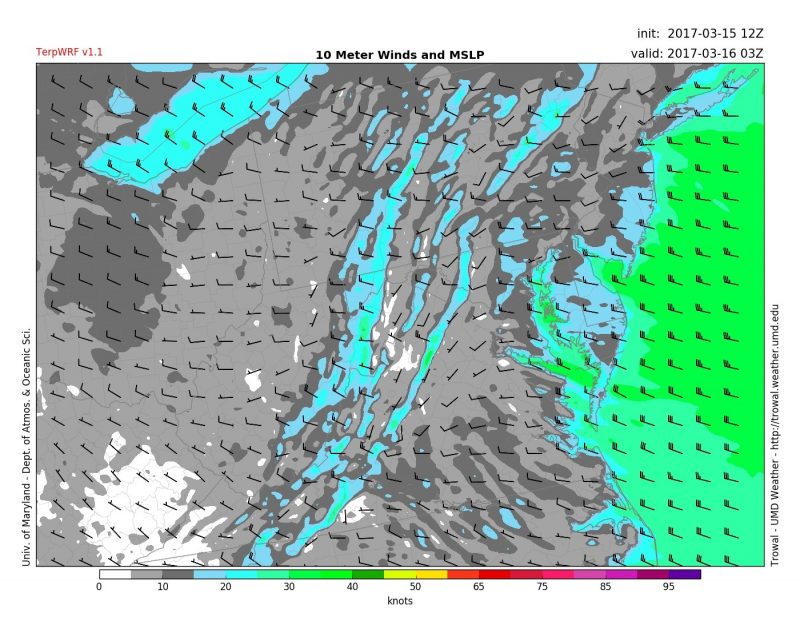
TerpWRF model displaying winds overnight across the region. (Source: UMD Trowal)

TerpWRF model data displaying overnight low temperatures in the teens and low 20’s. (Source: UMD Trowal)
Tomorrow (Thursday):
Breezy conditions should continue into your Thursday under mostly sunny skies, but tomorrow’s winds will be a bit calmer than today’s. Winds will persist out of the northwest at 15-20 mph, but occasional gusts may reach 30 mph. Temperatures will rise into the upper 30’s under the nice high sun angle of mid-March.