
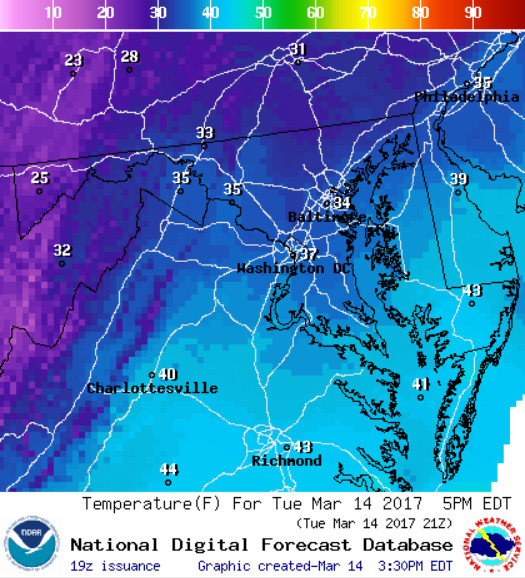
NWS WPC High Temperature for Tuesday, 03/14/17
Mother Nature finally brought out the big guns for the first time all winter. Today, we experienced a mixture of snow, sleet, freezing rain and frigid wind chills. We only received about 3 inches of snow with several layers of sleet piled on top. Staying inside on this wintry day was probably the best idea this morning. Icy conditions dominated the roadways and several accidents were reported on major highways. Fortunately, above-freezing temperatures (~35 degrees) helped icy surfaces and snow to melt. The wet, heavy snow was perfect for snowball fights on Mckeldin Mall (University of Maryland).
Through Tonight: Bundle up! As the winter storm looms along the East coast, cold arctic air will be thrown back into our region. Temperatures will fall way below average for this time of year with 20-degree and below temperatures across the District (see image 2 below). This will ensure that any melted snow will refreeze through the night and create dangerous driving impacts. That’s not all. Our arctic invasion will produce blustery 10-20 mph winds with gusts as high as 25 mph. The wind chills associated with these frigid lows will range from 8-15 degrees. Avoid staying outside for long periods of time. The nor’easter could probably produce a few scattered, non-accumulating snow showers through the night.
Tomorrow (Wednesday): A snowflake or two may pass you by! But, your biggest worry for the day will be how many layers you put on for your trek to class. The mercury will struggle to hit the freezing mark on Wednesday as highs will only be around 30 degrees. The wind chill, ranging from 9 to 15 degrees, will not help. Wednesday will be breezy as winds kick up into the 20-25 mph range with gusts as high as 37 mph. The clouds will hang around all day to really bring the wintry feel to campus.
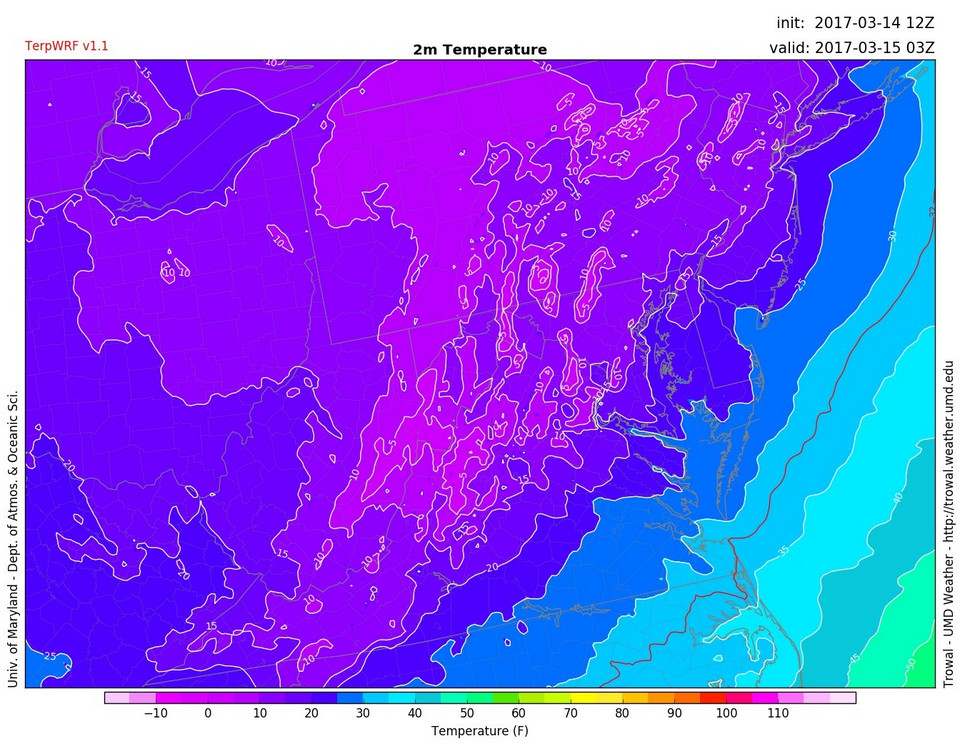
Image 2: TERPWRF displaying subfreezing temperatures for Tuesday night across the DMV (via UMD TROWAL)
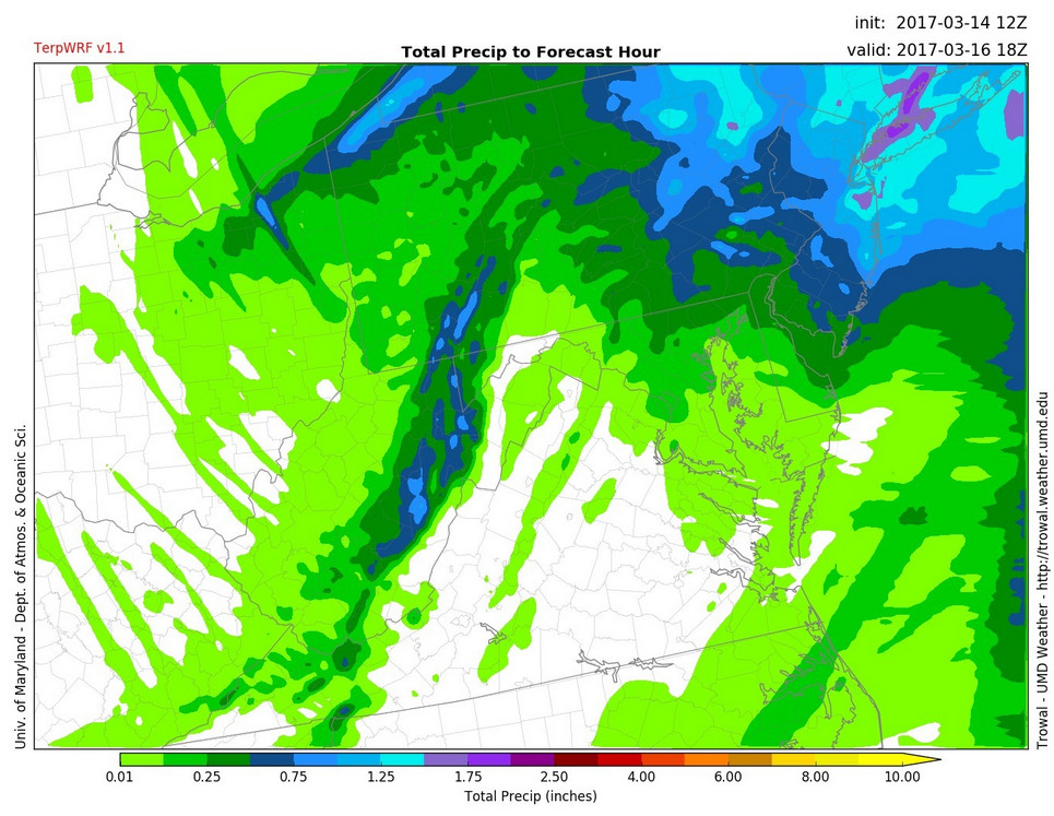
Image 3: TERPWRF displaying total precipitation totals from today until Thursday afternoon (via UMD TROWAL)