
Overview:
Old man winter made a return this weekend with high temperatures barely reaching 30 and lows dipping into the upper teens. Those freezing temperatures are being kicked out by a powerful low pressure system over south-central Canada. This storm will cause strong southerly winds, bringing the local area warmer weather and rain. The end of the week and next weekend is still in question as some models develop an upper level trough over the Eastern United States and as a result show the possibility of snow (gasp!).
Through Tonight:
Clouds blanket the sky as 5-10 mph winds out of the south bring in warm and moist air. Showers are possible mainly after midnight, but most of the precipitation will be light and focused to the north of College Park. Low temperatures will be mild, compared to recent nights, and bottom out in the mid 40s.
Tomorrow (Tuesday):
Tuesday will be cloudy, but warm. Southerly winds at 10-15 mph (gusting to 30 mph) will help bring in those warmer temperatures. Highs will reach the mid 60s before a cold front passes through later in the day. Rain chances will increase as the front passes, so prepare for a possible wet commute home.
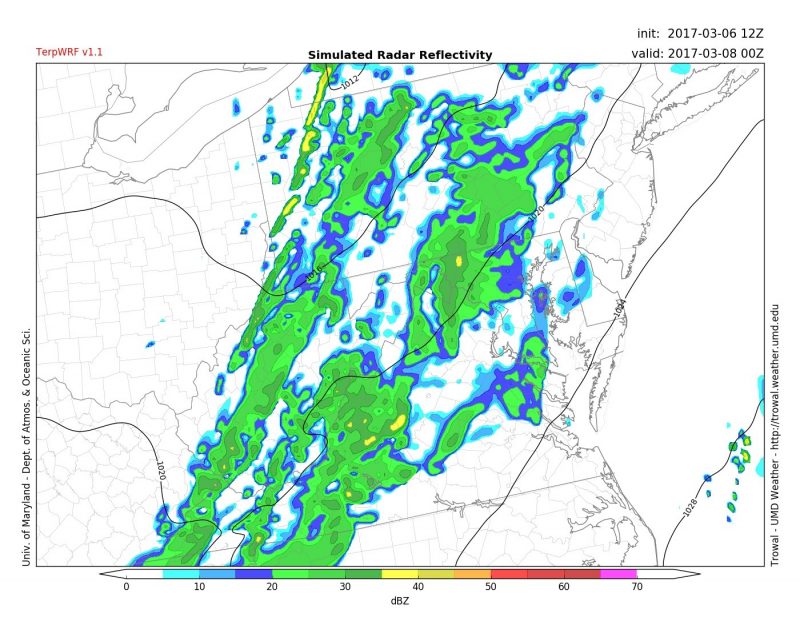
Our TerpWRF model shows showers across the region Tuesday at 7 p.m. (Via Trowal)
Looking Ahead:
We’ve seen this story many times this winter. Forecast models show snow a week out and then take it away once we get closer. That is why we are simply going to display what solutions are possible at this moment and update as the week progresses. Below is the latest GFS solution showing the chance for a light snow event Friday and then possibly a larger one on Sunday. The National Weather Service is also hinting at the possibility of some wintry weather in the future, but confidence is still very low.
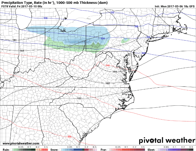
GFS model showing two snow chances this weekend. (Via Pivotal Weather)
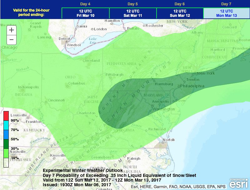
WPC showing a 30-50% chance of seeing 0.25″ liquid equivalent of snow/sleet for March 12th.
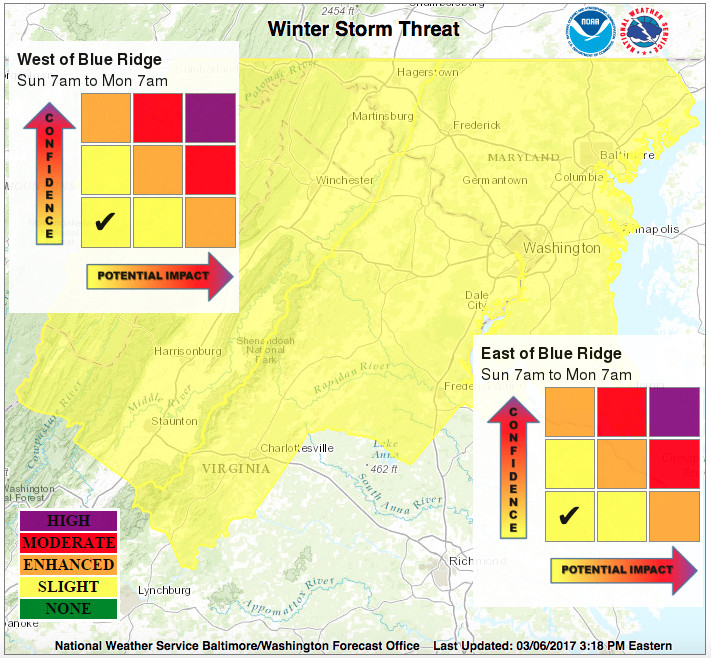
The NWS has issued a slight winter storm threat from Sunday morning to Monday. A slight threat means “if the threat materializes, it may cause travel disruptions.”
Follow UMD weather on Facebook and Twitter for the latest forecasts, as well as checking back here for daily updates around 5 pm.
Featured image via Pixabay