
Record warmth in February? Lack of ample snow? Yes, things have been unseasonably crazed and disappointing for most “snow lovers”. Hopefully, you aren’t too fed up with our furry little groundhog friend. Spring has been camping out at our doorstep for quite some time now. This spring-like February has been mostly comfortable and mild with daytime temperatures fluctuating between the mid-50’s and low-70’s. Since February 1st, DCA and IAD have observed the 2nd warmest average temperatures on record. According to our UMD TROWAL GFS model, the temperature anomaly model displays temperatures peaking around 14 degrees (Celsius) above normal for tomorrow evening (see image below). In the meantime, the warm spell will continue throughout the remainder of the week.
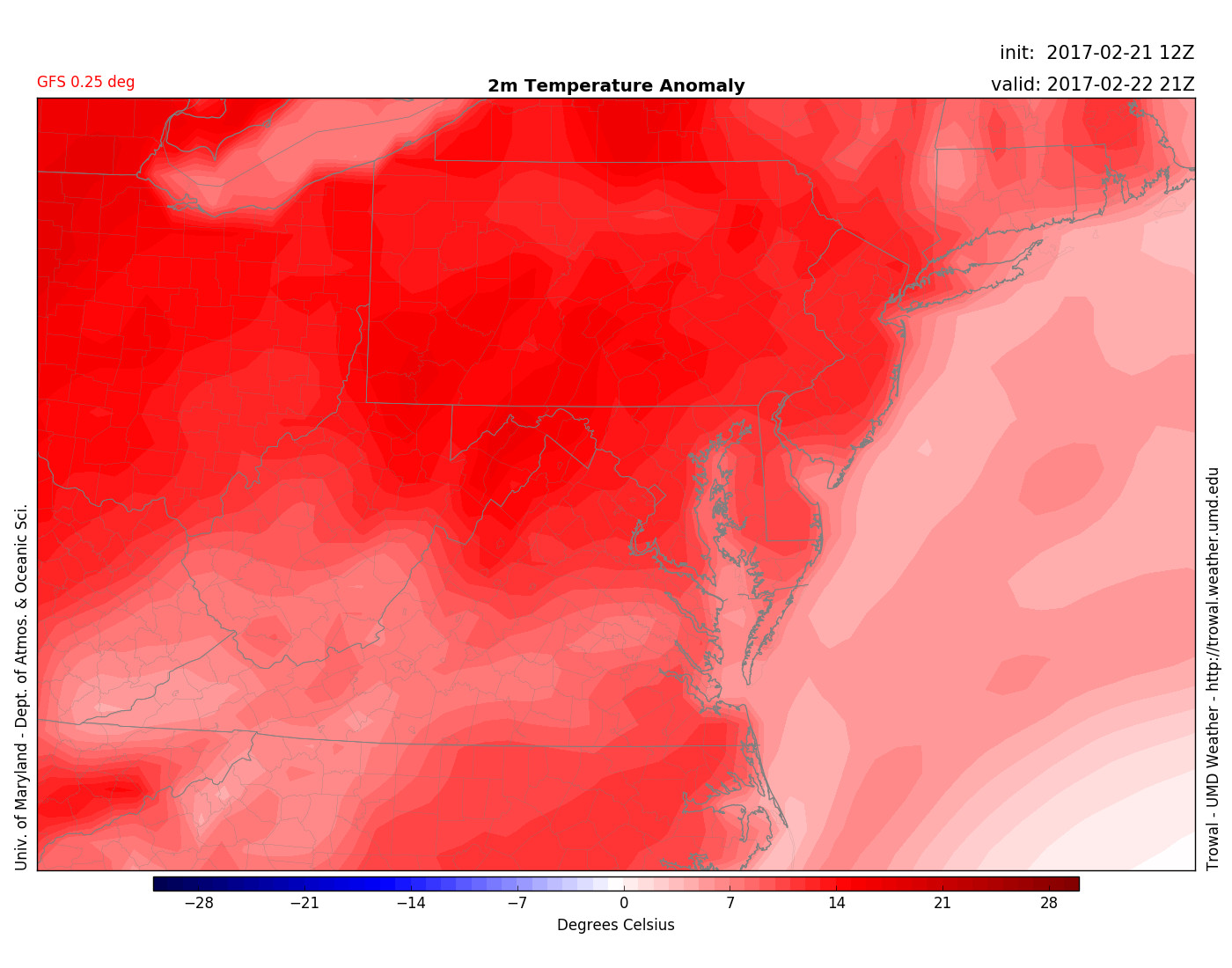
GFS 0.25 deg displays 14-degree celsius above average temperature anomaly for the mid-Atlantic region at 4 p.m. February 22nd (via UMD TROWAL)
Through tonight: A pretty clear and comfortable night to walk the dog. High pressure moving off the coast will allow for a light and mild southeasterly flow (5-8 mph) to breeze through the night. Mostly cloudy skies will hang around and overnight temperatures will remain 15-20 degrees above the average low for this time of year. In the suburbs, temps will drop to the mid-40’s. Upper 40’s will occur downtown.
Tomorrow (Wednesday): Most of you will wake up to 40-degree temperatures. A light jacket should be sufficient during your morning commute to campus/work. A fair amount of cloud cover will blanket the sky through Wednesday morning. As clouds begin to break throughout the afternoon, high temperatures will swing to the upper 60’s. A mild southerly flow around 5 mph will provide a light breeze.