

Some trees are already starting to show some color at the University of Maryland
This past weekend was nothing short of beautiful! High temperatures soared above average and allowed for many to get outside and enjoy. Due to the recent warmth, the Southeastern United States and parts of the Mid-Atlantic are seeing spring 2-3 weeks early compared to normal (See image below). A small cool down is on the way tomorrow, but spring-like conditions are set to continue the rest of the week.
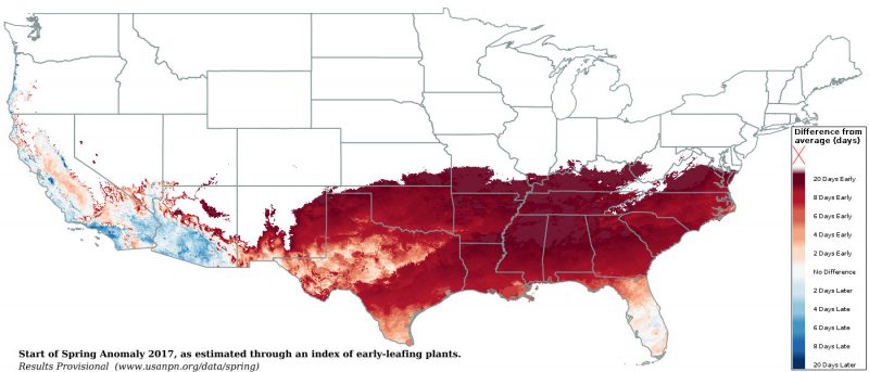
Spring has already begun in the Southeast according to an index of early-leafing plants. (Via USA npn)
Through Tonight:
Not the best night to leave your windows open. A ridge of high pressure to the north of the region will allow for temperatures to cool down into the upper-30s. Clouds may also become more noticeable as the winds shift to the east around 5 mph.
Tomorrow (Tuesday):
A light jacket might be necessary in the morning as temperatures start out in the low 40s. A mix of clouds and onshore flow from the east will allow for high temperatures to stay cool, relative to recent days. High temperatures will reach the low-50s, while east winds will be at 5-10 mph. Still a pretty nice day for February considering the average high is 49 degrees.
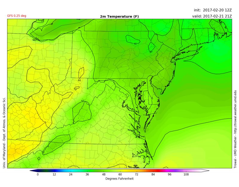
GFS model showing the 50 degree line right around College Park at 4 p.m. Tuesday. (Via Trowal)
Featured image via the author