
By midday, early morning clouds had given way to sunny skies across the DMV. A cold front brought some spotty showers to Southern Maryland as it moved through the area this morning. That same front ushered in gusty winds out of the northwest during the afternoon hours. Also, temperatures climbed into the upper 40’s.
Through Tonight: Expect clear skies tonight as the temperatures fall into the high 20’s. Gusty winds should persist through the overnight hours out of the northwest at 5-15 mph. Earlier today, The National Weather Service issued a Gale Warning and Small Craft Advisory for the Maryland portions of the Chesapeake Bay and Tidal Potomac that is in effect until noon Thursday.

TERPWRF model displays winds of 15-20mph across the area Wednesday evening (Source: UMD Trowal)
Tomorrow (Thursday): A cold and blustery start is in store for your Thursday morning with partly to mostly sunny skies. Layer up tomorrow! Temperatures will struggle to reach 40 degrees. Sustained winds of 10-20mph will impact windchill temperatures. It will “feel” like the 20’s and 30’s. Occasional wind gusts may reach 30 mph.
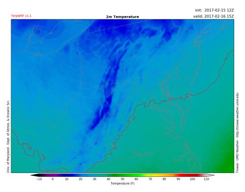
TERPWRF model displays Thursday morning temperatures around 10AM (Source: UMD Trowal)
Beyond the DMV
Compared to the relatively quiet weather in our region, parts of the West Coast have been experiencing an extremely wet week. After a short dry spell on Tuesday and Wednesday, more rain is expected to move into Northern California tonight and tomorrow. Over the next 48 hours, rainfall totals are forecasted to reach 2” or more in some areas. This extra precipitation is unwelcome news for the area, especially near Oroville, California, where the work continues to repair the damage to the Oroville Dam.
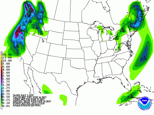
Precipitation forecast for the Continental US through Thursday. Rainfall totals of 2″ or more expected in the Pacific Northwest (Source: Weather Prediction Center)