
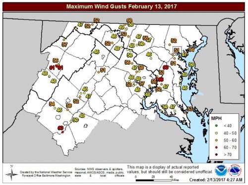
Peak wind gusts from Sunday evening’s wind event associated with the line that crossed the region between 930 PM and midnight (via NWS Balt/Washington)
Forecast Overview: Today was a blustery day across the region due to a mid-latitude cyclone situated off the coast. Once more, the storm will produce blizzard conditions within the New England region. The National Weather Service posted a gust of 66 mph at Reagan National Airport late Sunday Night. Also, there was some damage including downed trees, power lines, and even a roof was partially blown off an apartment. Between midnight and this morning, about 30,000 were without power in the Metro DC area. No major injuries have been reported.
Tonight: The Wind Advisory has now been canceled for the remainder of the evening. Still use caution while driving. Winds could still gust up to 50 mph. Later tonight, winds will continue to die down as the cyclone moves away from the Mid-Atlantic. Winds will diminish to 5-11 mph from the Northwest. The sky should be mostly clear, allowing the temperature to fall to around 30 degrees.
Tomorrow (Tuesday): While cold in the morning, Tuesday will warm up nicely (good day to stroll through the park with your valentine). Throughout the day, it will remain calm and pleasant with high temperatures in the low 50s. Under mostly sunny skies, winds will be much calmer than today (5-9 mph from the Southwest). Tomorrow evening will be warmer than tonight with a low temperature in the mid-30s and wind speeds around 6 mph from the Southwest.
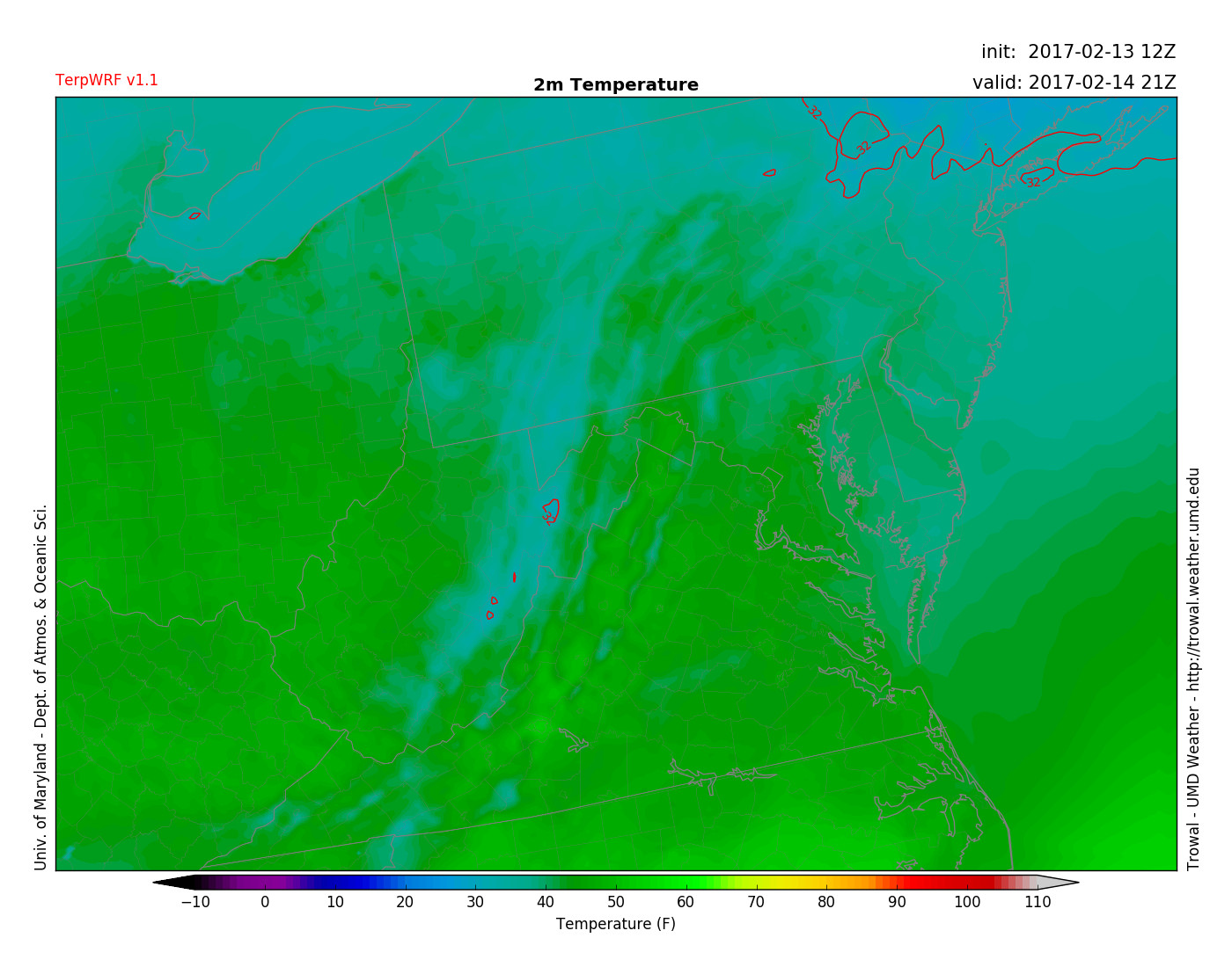
TerpWERF model image shows the afternoon temperature for Tuesday (around 50 degrees) at 4 pm (via UMD TROWAL)

TERPWRF model displays calm winds for Tuesday morning around 7 am (via UMD TROWAL)