
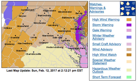
NWS has issued High Wind Warnings for all of Central Maryland (Via NWS)
Forecast Overview:
The warm front never made it north of the region today and temperatures remained fairly cool under overcast skies. This generally quiet weather is about to take a turn and make for a very noisy night. Thanks to a meteorological “bomb” off the coast of New England, that is giving some places in Maine feet of snow, strong winds are going to wreak havoc tonight through tomorrow. The National Weather Service has issued a High Wind Warning for the College Park area and surrounding counties. This warning goes into effect at 11 p.m. and lasts until 6 p.m. on Monday. Winds will be sustained at 25-35 mph, gusting as high as 60 mph! The strongest winds are expected to occur overnight and around sunrise.
Through Tonight:
Secure any loose outdoors items and put on your earplugs if you want to get a good sleep. Winds will pick up in the evening to 10-15 mph and really start to whip around midnight at 20-30 mph. Gusts could be as high as 60 mph. These can cause fallen trees, fallen limbs, and isolated power outages. Temperatures will also drop into the mid 30s with wind chills into the teens.
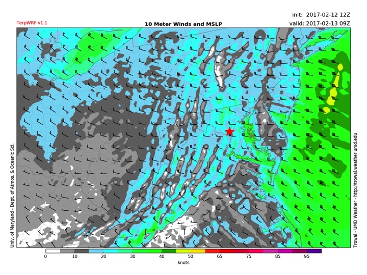
TerpWRF showing 25-35 mph sustained winds for College Park (red star) at 4 a.m. (Via Trowal)
Tomorrow (Monday):
Skies will be mostly sunny, but temperatures will only make it into the mid 40s. Winds will still be a problem at 20-30 mph out of the northwest, gusting as high as 55 mph. They will slowly die down as tomorrow evening approaches. Give yourself a little extra time if traveling in the morning as trees and power outages could cause some back ups.
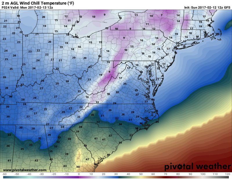
GFS showing wind chills for Monday morning at 7 a.m. will be in the teens for the College Park region. (Via Pivotal Weather)