What a beautiful last few days we have had across central Maryland! However, back-to-back days of record breaking warmth can never go without a little payback from mother nature. Starting tonight temperatures will crash as mixed bag of precipitation moves into the area. Although we are expecting some light snowfall tomorrow morning, accumulation and impacts should be minimal around the College Park/DC area.
Chance that the University of Maryland has a delayed opening: 50%
Chance that the Univiersity of Maryland closes: 10%
Through Tonight:
Temperatures will steadily fall throughout the night as the first wave of precipitation arrives as early as 10 p.m. It will be too warm to support snowfall until around 6 a.m. Therefore, we don’t expect any travel concerns overnight. Winds will pick up to 10-15 mph out of north (bringing in colder air) and possibly gust up to 20 mph.
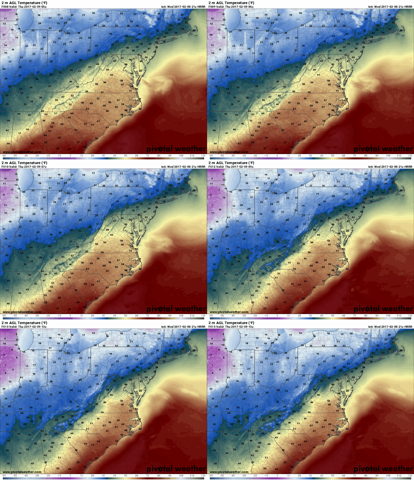
HRRR shows temperatures from midnight to 5 a.m. Temperatures still above freezing, but you can see the freezing line racing south. (Via Pivotal Weather)
Tomorrow (Thursday):
Thursday morning is when it gets interesting. Here is a timeline of what to expect in College Park:
4:00 am-6:00 am:
Starting around 4 am the rain/snow line has entered northern Maryland and is pushing southward into College Park. Areas of Howard, Baltimore, and Carroll counties should see an extended period of snowfall that will add up to 1-3 inches on grassy surfaces. It is tough to tell how much will stick to roadways due to the warmth the last two days, but heavy snowfall rates can lead to slick roads.
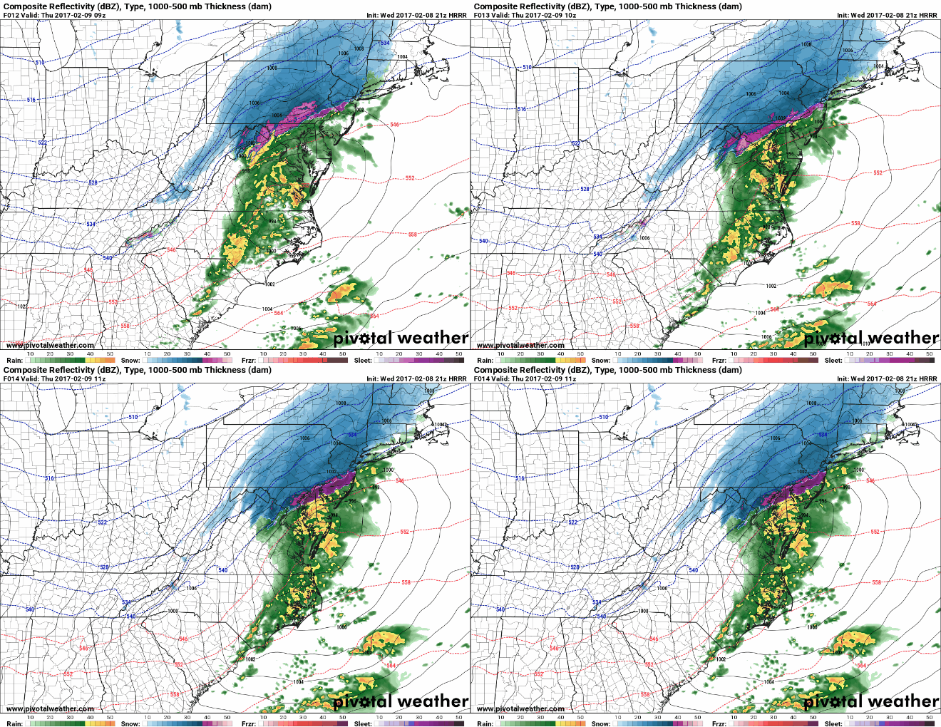
HRRR shows the rain/snow line spreading south between 4 a.m. and 6 a.m. (Via Pivotal Weather)
6:00 am-8:00 am:
Rain changes to snow from north to south across PG county and DC. The snow could be heavy at times. This will reduce visibility on the roads. Temperatures will be right around freezing so roadways should be just wet, however; bridges and sidewalks may become covered if it is snowing heavily. Accumulations on grassy surfaces may reach an inch or two around College Park. Areas towards the north, such as Howard and Baltimore, could see a total of 2-4 inches. Winds will also pick up to 15-20 mph, gusting to 25 mph.
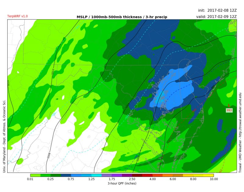
TerpWRF shows College Park north of the Rain/Snow line (blue dashed line) at 7 a.m. This would equate to some heavy snowfall at this time. (Via Trowal)
8:00 am-10:00 am:
Snow becomes lighter and tappers off from west to east during this period as temperatures bottom out right around 32 degrees. Winds continue to howl around 20 mph out of the north.
Through Thursday Evening:
Temperatures stay in the 30s and winds whip at 20-25 mph, gusting to 40 mph. Skies stay mostly cloudy throughout the day. There is also a chance for some lake effect snow squalls to pass through the region during the evening rush hour. Therefore, it is recommended to check the weather conditions when traveling tomorrow to avoid a surprise.
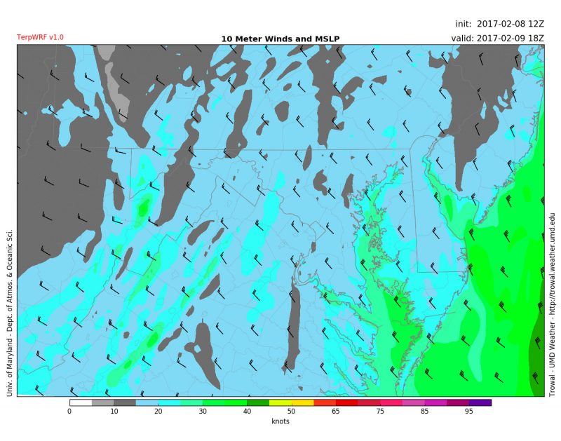
TerpWRF showing winds around 20 mph at 1 p.m. Thursday. (Via Trowal)
What could go wrong?
This type of storm and forecast depends on the exact timing of the heavy precipitation and cold air. If the precipitation leaves the area before the cold air arrives, then a few snow showers would be the only concern. If the cold air arrives sooner, then heavy snowfall could cause accumulation and travel concerns during the morning rush hour. Since this forecast is very fluid, I recommend setting your alarm just a little earlier so you can check conditions before venturing out.
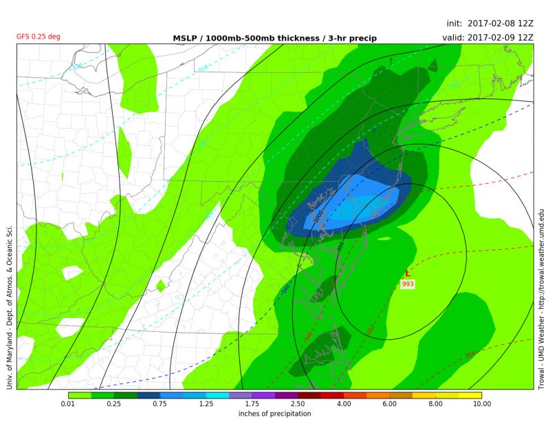
GFS model showing the concern for very heavy snowfall around 7 a.m. in the College Park area. (Via Trowal)
Follow us on Facebook and Twitter (@UMD_weather) for updates throughout the night and early morning as conditions change!
