

Ice shut down most of the central Plains this past weekend. (Credit: Pixabay)
Most areas around the nation’s capital were spared from significant ice accumulation this past weekend. On the other hand, parts of the central Great Plains were turned into an ice rink, with spots seeing over an inch of freezing rain! Back in Maryland, we take mother nature’s roller coaster yet again, as our temperatures will rebound from ice and subfreezing weather this weekend well into the 50s and potential rain throughout the week.
Through Tonight:
Our cloudy weather during the day persists as the sun sets, as winds out of the south will stay relatively calm. Temperatures will dip into the upper 30s and near 40 as we see a small chance of showers as well. Later on in the night, the chances of precipitation will increase ever so slightly.
Tomorrow (Tuesday):
A thick deck of clouds will blanket the DMV tomorrow as well, as southerly 5-10 mph winds accompany us. A warm front progressing through will help push the temperature into the low to mid 50s, and increase our likely hood of rain showers to 70-80% for tomorrow, especially in the afternoon. Except no torrential downpours, as we should see at most around a tenth to a quarter inch of rain. Our pattern of cloudy and dreary weather this week will continue to give us a hiatus on true winter.
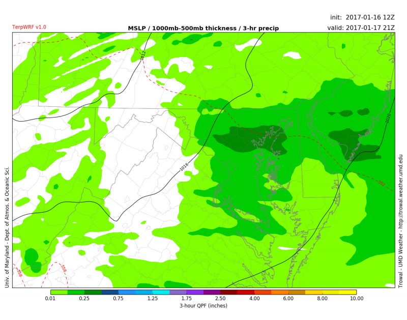
Rain showers covering our area tomorrow at 4 p.m. (Credit: Trowal)