
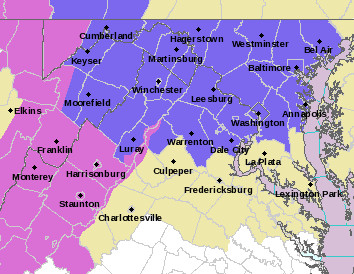
The NWS has issued a Winter Weather Advisory for the counties in purple (Via NWS)
After some pleasant and mild weather, it looks like winter will return just in time for the weekend. The strong southerly winds that have kept the College Park region in above average temperatures have shifted and are now bringing in colder air from the north. The cold front that has brought in this cooler air will stall just to the south of the region. Simultaneously, a high pressure system to the north will feed in more cold air between the mountains and coast–causing it to become trapped (otherwise know as “damming”). This sets the stage for a long period of mixed precipitation as waves of moisture move across the stalled frontal boundary. If you’re planning on traveling this weekend, we recommend you to check current weather and road conditions before venturing out.
Through Tonight:
Mostly cloudy skies and cold with temperatures likely dropping to around freezing by early morning. Lows will settle in the upper 20’s in the northern suburbs and low 30’s around College Park. As early as 1 a.m., precipitation may begin to develop as snow or sleet. Snow and sleet showers will be on and off throughout the rest of the night before possibly becoming steadier by morning. Any snow/sleet accumulations will be minor and less than half an inch. Winds will be out of the northeast at 5-10 mph.
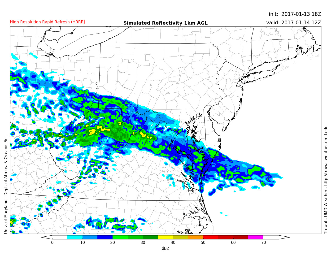
HRRR model shows precip moving in around 7 am (Via Trowal)
Tomorrow (Saturday):
A good day to just stay indoors by the fireplace as snow, sleet, and freezing rain will fall throughout the day. Snow and sleet are expected to fall during the morning hours with total accumulations between a coating and 1 inch. The higher amounts are expected to be to the north and west of the DC area. By mid-day, snow and sleet are expected to change over to freezing rain as light pockets of moisture move through areas with near freezing temperatures. Ice is expected to accumulate up to a tenth of an inch. Saturday’s high temperatures will hover around 32 degrees with warmer temperatures to the south. Therefore, any untreated surfaces could be icy throughout the day (especially north of the beltway). Any ice is bad ice as we saw last December. Winds will be out of the east around 5 mph.
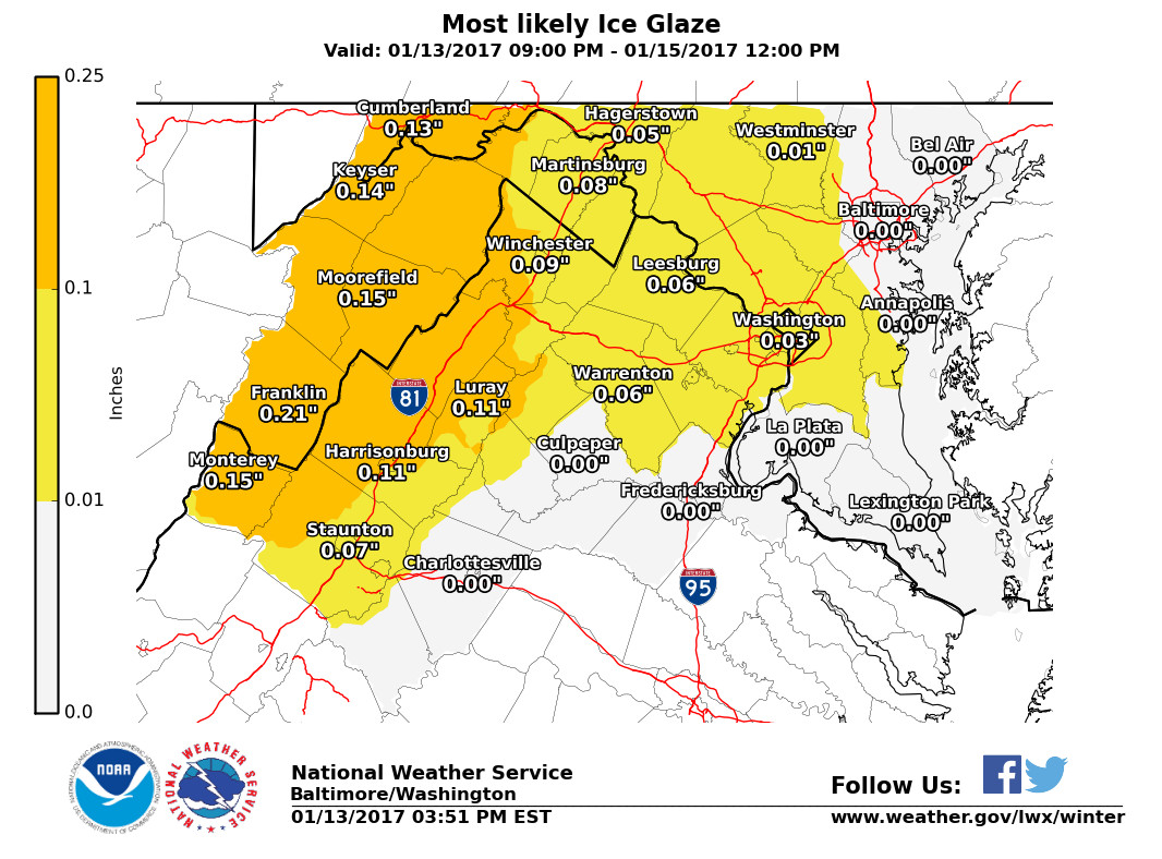
NWS ice forecast shows a general glaze across the region, but any ice can cause problems (Via NWS)
Saturday Night:
Light freezing rain or sleet is still possible as we head into the overnight hours. Temperatures will stay around the freezing mark with colder pockets to the north. If you have travel plans, make sure to drive cautiously. Winds will be out of the southeast around 5 mph.
Sunday:
Another cold and dreary day as rain and freezing rain is possible during the morning before changing to all rain by noon. Temperatures finally edge above freezing with highs in the upper 30’s. However, they will fall back to around freezing by nightfall and any precipitation will switch back to sleet or freezing rain.
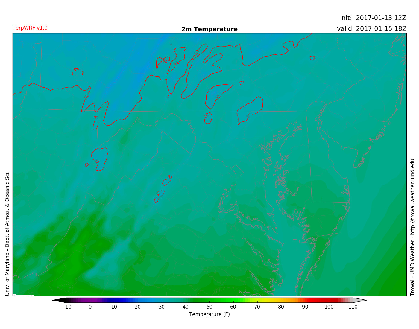
TerpWRF shows temperatures above freezing for almost all of the region by 1 pm Sunday (Via Trowal)
(Feature photo courtesy of Pixabay)