
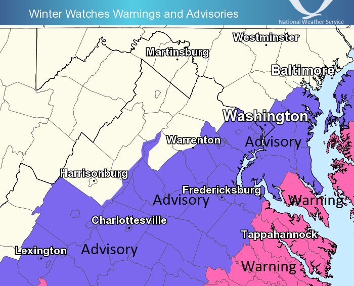
Locations under a winter weather advisory (shaded purple) expected to receive 1-3 inches of snow. Winter storm warnings issued for locations shaded pink could receive 3-6 inches of potential snow amounts (via NWS)
Parts of Southern Maryland and Northern Virginia have been issued winter weather advisories and winter storm warnings. According to the National Weather Service, a winter storm warning is in effect for St. Mary’s County, Maryland on Saturday from 1 am to 7 pm. Augusta County, Virginia to Anne Arundel County have been issued winter weather advisories from 1 am to 3 pm on Saturday (see image above). Currently, a strengthening low pressure system near the Gulf coast is tracking toward the mid-Atlantic region. As it approaches the DMV area, ample moisture flow will help the storm to intensify off the coast of the Carolinas and produce snow showers across the region. However, colder and drier air on the northwest region of the surface low (near northwestern Maryland) will cut off snow accumulation totals and limit snowfall along and north of the District.
Through Tonight:
The remainder of the evening will remain pretty dry and quiet. Temperatures will be dropping about 10 degrees below the 32 degree freezing mark for College Park and DC. An 8 to 11 mph northerly wind flow will impact wind chill temperatures. After 1 a.m., light snow showers will begin to develop across southern Maryland and northern Virginia.
Saturday: Tomorrow’s weather will be frigid and windy. 10 to 15 mph northerly winds will accompany up to 20 mph wind gusts. By 7 a.m., a swath of snow showers will extend across Virginia, DC and southern/eastern Maryland. Up until 3 pm, light snow showers will persist. Potential snow amounts will range between 1-3 inches from Lexington, VA to Anne Arundel County. St. Mary’s county faces the potential for 3-6 inches of accumulating snow. The storm will begin taper off before the late evening hours. By Saturday night, frigid cold air will place overnight temperatures in the teen digits (around 15 degrees for College Park).
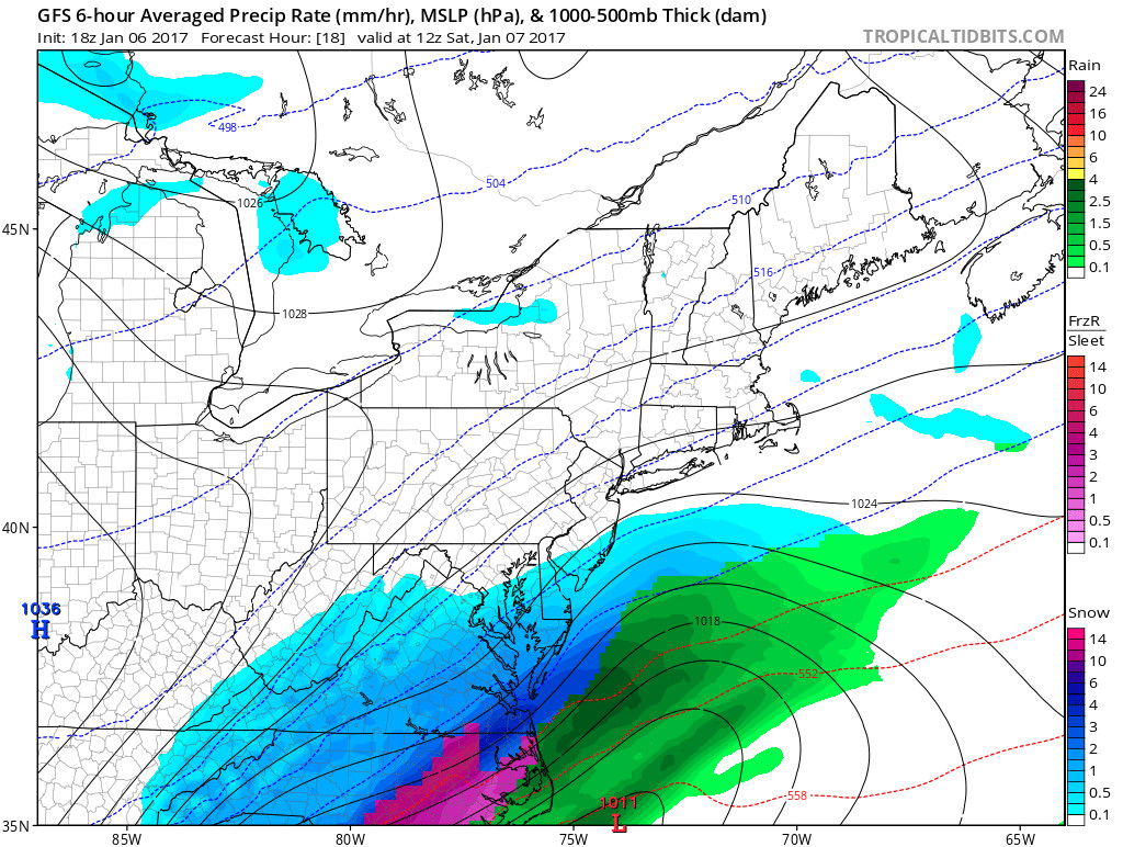
By Saturday 7 a.m., GFS displays snow developing across southern Maryland and Virginia (via Tropical Tidbits)
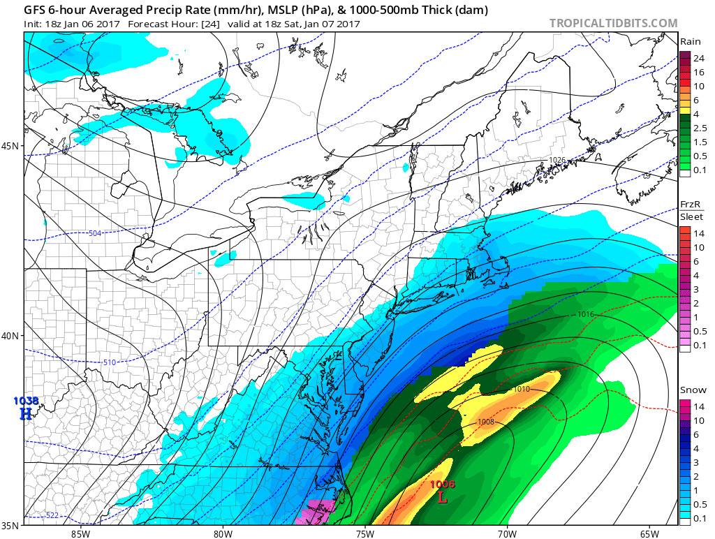
By Saturday 1 p.m., GFS model displays snow developing across southern Maryland, Northern Virginia and locations north of the District (via Tropical Tidbits)
Sunday: High pressure will finally allow clear skies to prevail behind the storm system. 25+ mph wind gusts will result in a windy Sunday. High temperatures climb to the mid 20’s (still cold!).
Stay tuned to @UMD_WEATHER for updates pertaining to Saturday’s winter weather! Feel free to tweet us your photos.
(Feature photo courtesy of David Crawford)