
Today’s weather has been much of a cool off from yesterday’s anomalously warm weather. Weather Underground reports that we reached a high of 64 degrees yesterday, the warmest temperature on record for this December. We saw more seasonable weather today, which should be the case for the remainder of our 2016.
Through Tonight:
Our weather becomes more active tonight as a frontal system activates southwesterly winds to bring in moisture ahead of our cold front. After about 3 a.m., the rain will hit our area and stick around for a few hours into the morning. Some areas to the north and west may see a period of wintry mix. Carroll, Frederick, and Loudoun counties, and westward could see some slick spots into the overnight hours. Although, with temperatures as high as they’ve been, do not expect any of the frozen precip to stick on the ground long at all. Low temperatures should hover in the mid 30s.
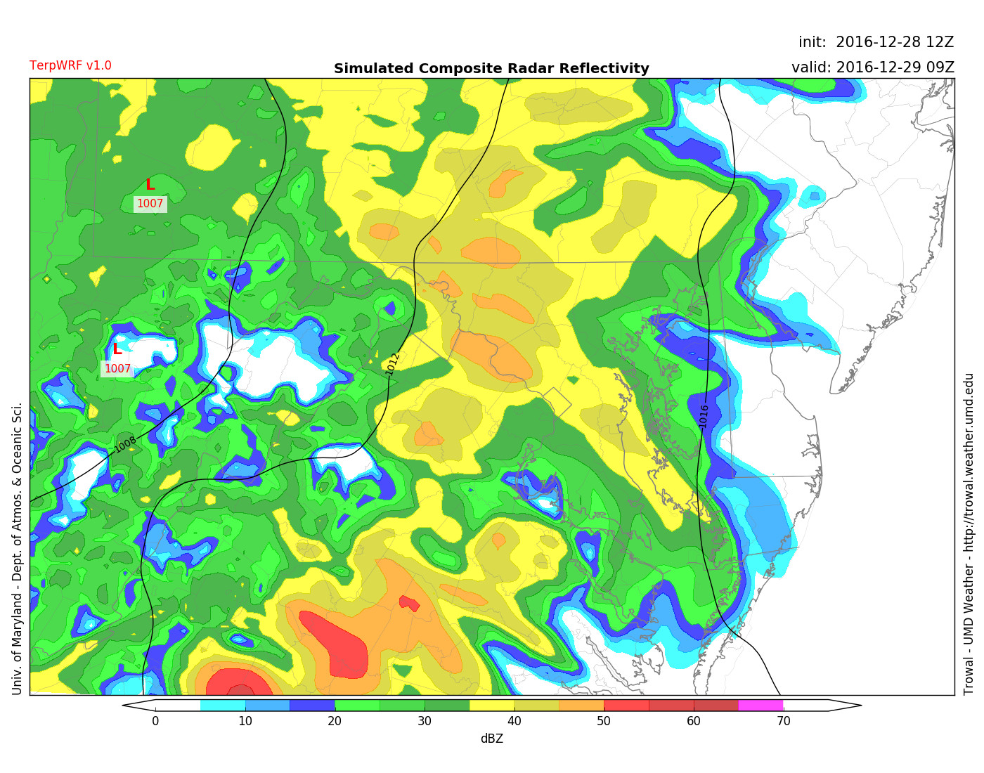
Light to moderate rain into the early morning hours for us. (Credit: Trowal)
Tomorrow (Friday):
We will wake up to rain continuing throughout our morning. The rain will not persist for too long, so rain amounts will likely be around 0.1 inches, with some areas topping around 0.2 inches of rain when all is said and done. Winds around 10-15 mph out of the south/southwest will accompany the wet weather. Clouds will stick around for most of the day until late afternoon, when the front fully passes through and gives us clearer skies. Our high temperature will be approaching 50 degrees. Unfortunately for those of us who are snow lovers, we won’t probably see snow until 2017.