
This morning was the coldest December morning in D.C. since 2008 (17 degrees) and has set the stage for icy conditions starting tonight. It may not be a snow storm, but even a light glaze of ice has the potential to cause isolated power outages and treacherous roadways. The good news is that temperatures will be rising throughout the day Saturday and conditions should improve around mid-morning. The wet weather continues into Sunday as a cold front moves through and brings back the cold temperatures.
Through Tonight:
The National Weather Service has issued a winter weather advisory that goes into effect at midnight and runs until 9 am. The advisory calls for a trace of snow and sleet along with a tenth of an inch of ice. Precipitation will start around midnight as snow or sleet. Up to a half-inch of snow is possible in the College Park area, but lesser amounts are likely. Northern regions of Maryland can expect as much as 1 inch. Snow and sleet will transition to freezing rain around 4 am and leave a thin glaze of ice by morning. Winds will be out of the south at 5 to 10 mph.
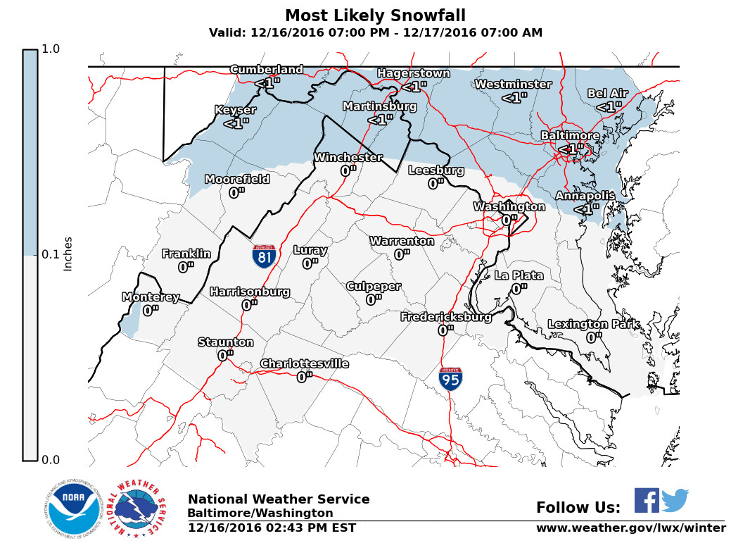
NWS snow forecast shows less than 1 inch is likely across the region. (Via NWS)
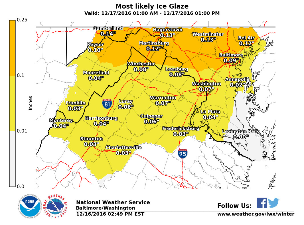
NWS ice forecast shows around a tenth of an inch around College Park with increasing amounts to the north. (Via NWS)
Tomorrow (Saturday):
Rain and freezing rain continue through the early morning as southerly winds erode away the arctic air that had been in place. Ice amounts could reach a tenth of an inch around the region with increasing amounts to the north. Temperatures should make it above freezing by mid-morning and cause the ice and snow to melt quickly as road conditions improve. Highs will range from 44 degrees outside the beltway to 46 degrees closer to the city. Showers will stick around through the afternoon and winds out of the southwest will pick up to 10-15 mph. Nighttime temperatures will not drop, but actually continue to rise as we head into Sunday. Therefore, refreezing of water is not a concern.
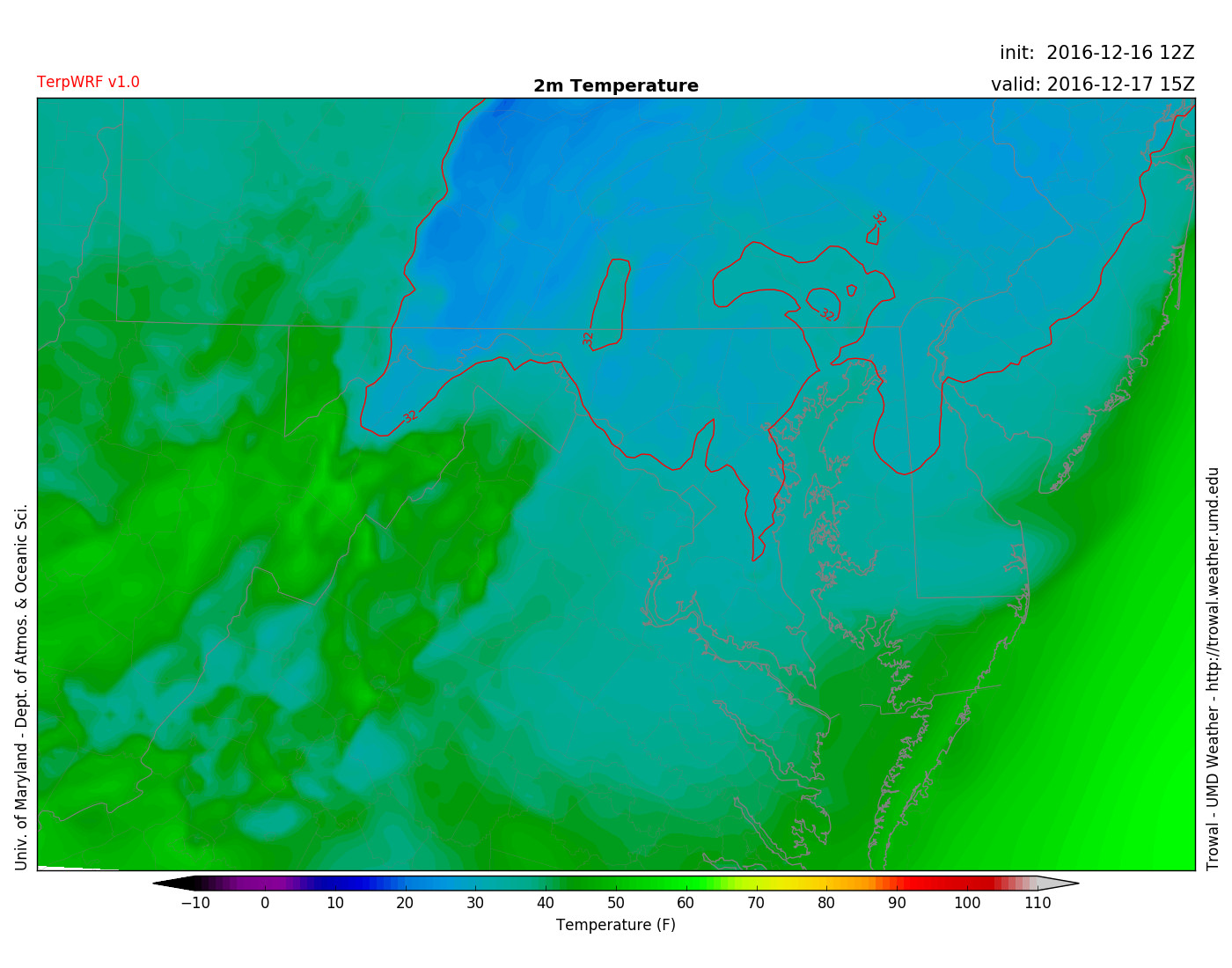
TerpWRF showing temperatures above freezing in College Park by 11 am, but still below freezing to the north. (Via Trowal)
Sunday:
Sunday will start out with a warm surprise with temperatures possibly around 60! However, they will drop throughout the day as a cold front approaches. Rain will also accompany the cold front with rain totals up to a quarter of an inch. As night approaches the rain has a slight chance of changing to snow, but any amounts seem negligible at the moment. Temperatures will decrease throughout the night, into the mid 20s, causing for some refreezing of any moisture on walkways or roadways.