
An active weather pattern will continue for the mid-Atlantic over the next 36-48 hours. The remnants of a powerful storm system located over Minnesota will fuel the creation of a new surface low pressure near Ohio by Wednesday afternoon. Meanwhile, the mid-Atlantic will be stuck in a strong, southerly flow ahead of a potent cold front attached to the developing Great Lakes storm. We are in for a wide variety of weather hazards before the cold front moves through late Wednesday, including dense fog, heavy rain, isolated thunder and strong winds.
Through Tonight:
The majority of the rain has already fallen for the DC/Baltimore area. Some scattered showers remain, but mostly over eastern Maryland and Delaware. Overnight temperatures will be quite mild. In fact, overnight lows will be warmer than our average high temperatures for this time of year. Temperatures will settle in the mid 50s region wide. Dewpoints will also be in the mid 50s and even rising overnight. With ample amounts of low-level moisture, widespread areas of dense fog seem likely. Visibility could be limited to 1/4 mile or less in some locations.
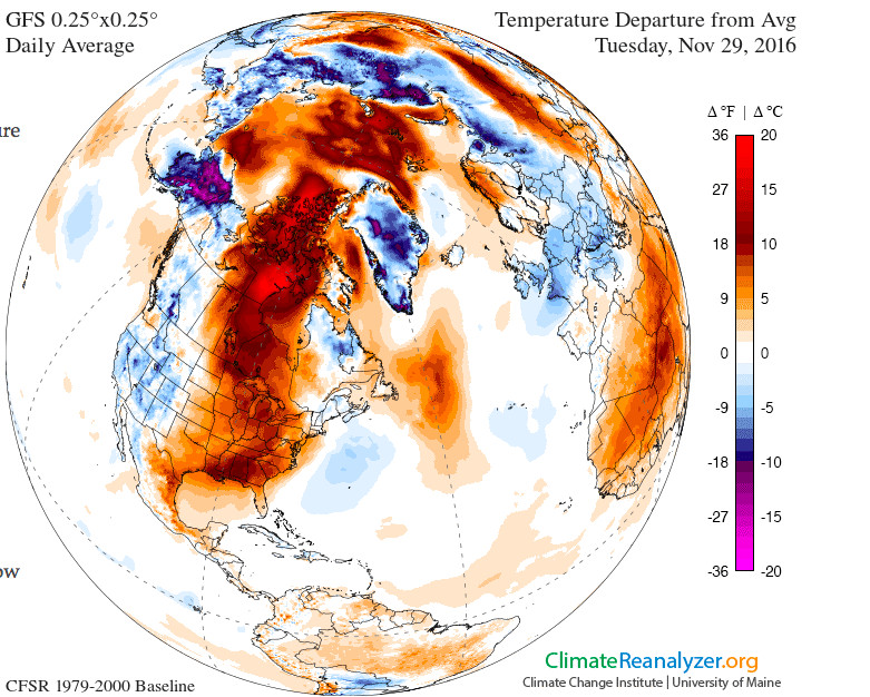
Warm temperature anomalies (Tuesday Nov 29th) extend into the Arctic. GFS via Climate Reanalyzer.
Wednesday:
Wednesday figures to be the most active weather day we’ve seen in quite some time. Dense fog will make the morning commute tough. Additionally, a large area of moderate to heavy rain will be close to the DC area by 8am. With a lot of atmospheric instability in place, some isolated thunderstorms are certainly not out of the question. Drying out by the afternoon with continued anomalous warmth. Temperatures could hit 70 degrees for a time tomorrow, with most of us settling in the upper 60s. Winds from the south will be strong at 10-20 mph. Gusts over 20 mph are likely. Mostly cloudy with some scattered showers through the evening before a cold front moves through late night, bringing cooler and drier air for Thursday.
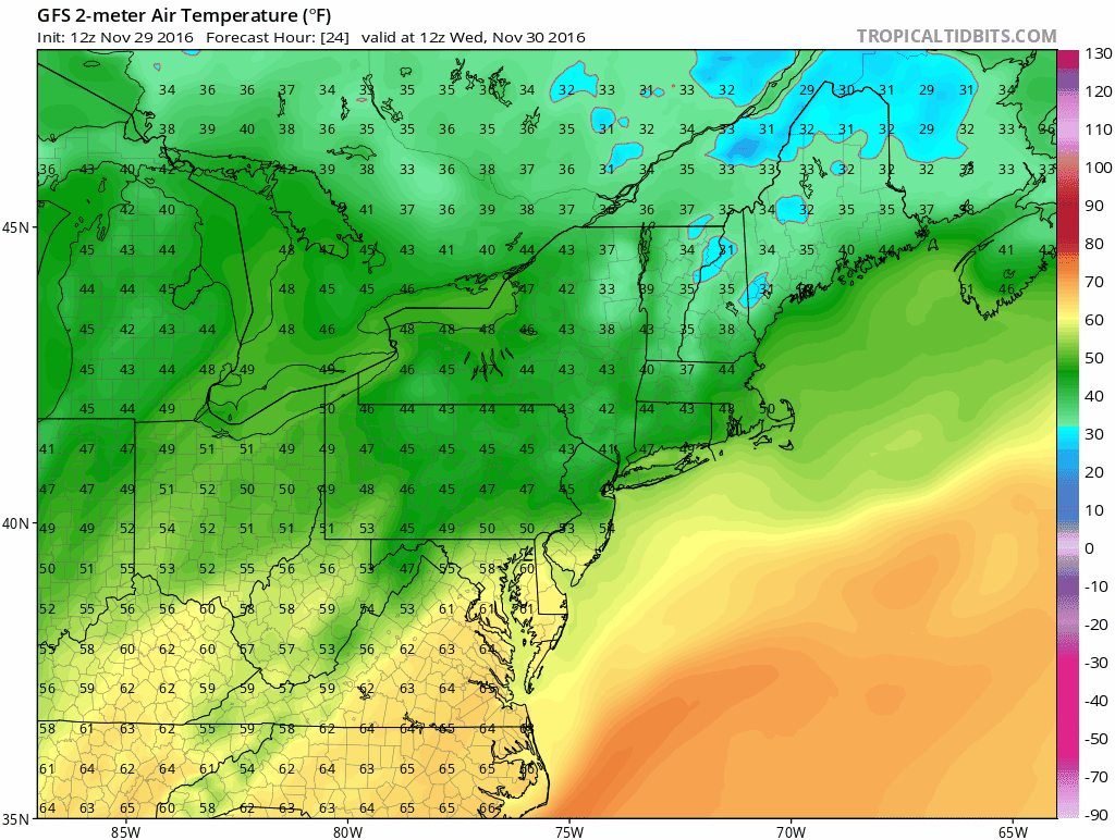
Temperatures spike tomorrow before more seasonable temps for Thursday. GFS via Tropical Tidbits