
Welcome back from Thanksgiving break! Earlier, fair weather and mostly sunny skies boosted temperatures to near normal conditions with highs around the low-to-mid 50’s. An approaching warm front will produce an unseasonable warming trend through Wednesday.
Tonight: Mainly cool and dry with increasing cloud cover. Winds flowing out of the south will bring in warm air and keep temperatures well above freezing for tonight. As overnight temperatures fall into the mid 40’s, they will be around 20 degrees warmer than last night. Southerly wind speeds are expected to produce breezy conditions with winds gusting around 20 mph (mainly in higher elevations and near bodies of water). There remains a slight risk for light showers after midnight.
Tomorrow (Tuesday): A raincoat and an umbrella is well needed for tomorrow. By 7am, light-to-moderate scattered rain showers are likely for the morning commute hours (image below). Showers will persist into the afternoon and remain favorably scattered. Southerly winds combined with mainly cloudy skies will lock in warmer air. Therefore, maximum temperatures could climb up to 10+ degrees above the 53 degree normal temps.
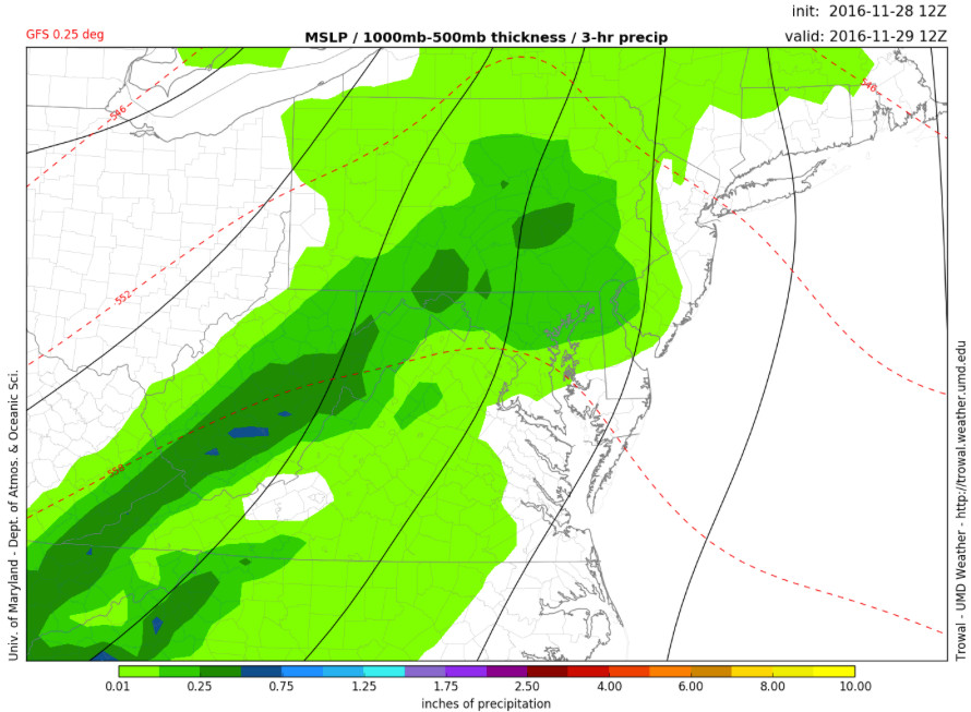
University of Maryland GFS 0.25 deg model displays rain showers for November 29th (tomorrow) around 7 AM via UMD TROWAL