
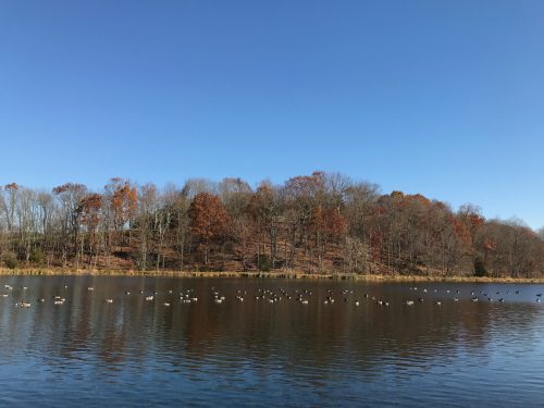
Friday’s weather was good as it gets (Photo Credit: Cody Snell)
Friday’s weather could not have been any better across the region. High temperatures reached into the upper 60s and low 70s (10-15 degrees above normal), while high pressure allowed for virtually cloudless skies. These conditions won’t stick around much longer as a strong cold front will swing in on Saturday afternoon bringing clouds, a possible shower, and cold temperatures. Rain amounts should be light though and won’t be enough to help the growing drought conditions. We are left with more clear skies once the front exits, but with much colder conditions.
Through Tonight:
Skies will stay mostly clear and temperatures will be comfortable throughout the evening. Winds will be light and out of the southwest. Low temperatures will reach the mid 40s in the northern suburbs and low 50s closer towards the city. Patchy fog is also possible during the early morning hours.
Tomorrow (Saturday):
The day starts out gorgeous with sunshine and high temperatures peaking near 70 degrees before the approaching cold front moves into the area. Clouds should start to move in around mid-afternoon and push across the region from west to east. Any showers that stay together would come through between 4 and 7 p.m. with very light (if any) amounts of precipitation. Winds will change directions during the day by starting out between 10-15 mph out of the southwest. Once the cold front arrives they switch and become quite gusty out of the northwest at 15-20 mph. Winds will stay like this throughout the night as the cold front leaves the area with temperatures into the 30s. A snow shower (yes snow shower) is not out of the question in the far west and northwestern suburbs on Saturday night.
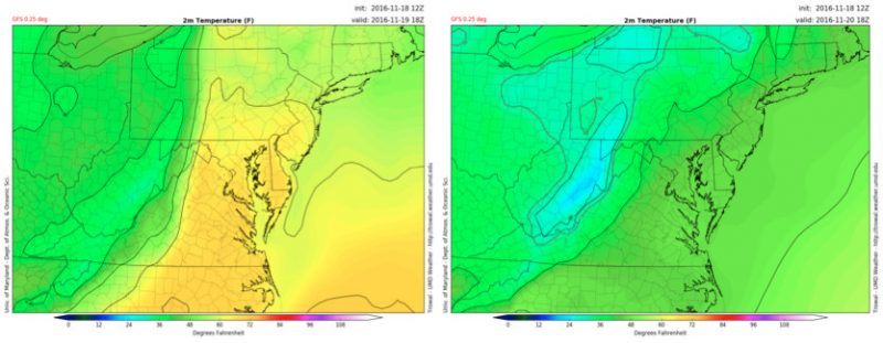
Saturday (Left) and Sunday (Right) will feature very different high temperatures (Via UMD TROWAL)
Sunday:
The sun returns, but brisk westerly winds remain as high pressure builds in behind the cold front. High temperatures won’t make it out of the 40s, so bundle up if you are spending any time outdoors!
Drought Monitor:
Just a friendly reminder that central Maryland (including College Park) is in a moderate drought. Please be careful with bonfires, cigarettes, or anything that may cause a fire. In fact, the Frederick County Fire Marshall’s Office has issued a total ban on outdoor burning until further notice. Through the next week drought conditions are projected to remain the same or increase.
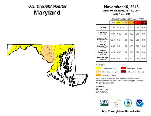
Most of Maryland is experiencing drought conditions (Via Drought Monitor)