
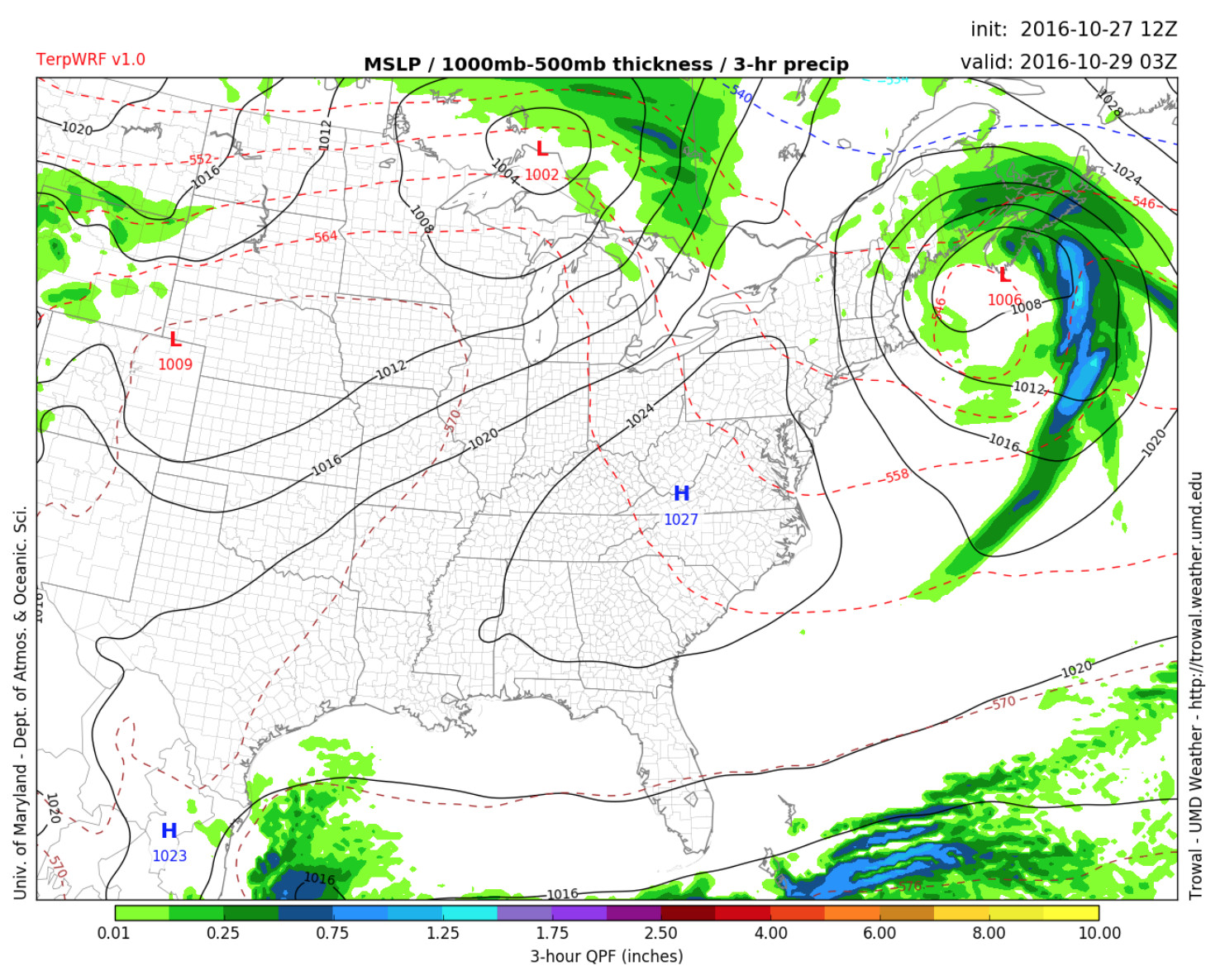
High pressure moves in over the region for the weekend. (Credit: UMD Trowal)
Forecast Overview
Following a cool and dreary Thursday, high pressure will build in during the day to set up a lovely Halloween weekend. The high pressure ridge is expected to produce a shift in the wind direction and push in an unseasonably warm air mass from the south. As you prepare for Halloween, the weekend will be a spectacular opportunity to host parties, trick-or-treating or maze through a few haunted houses. Saturday should be the warmest day of this weekend with temperatures reaching 10° above average. During Sunday’s Marine Corp Marathon, summer-like conditions should be ideal for both runners and spectators.
Friday
Thanks to a high-pressure system building in from the west, clear skies and cooler temperatures will return on Friday. The day will start out chilly with early morning temperatures in the low 40’s. Later, high temperatures will climb into the low 60’s. Higher temperatures are expected for southern parts of the region. Breezy conditions will continue throughout the day as a sharp pressure gradient migrates over the area. Throughout the afternoon, winds flowing out of the northwest at 10-20 mph will be accompanied by higher gusts of up to 25 mph. Friday evening will be cool with temperatures falling into the low 40’s.
Saturday
On Saturday morning, pleasant conditions will stick around while mostly sunny skies persist throughout the day. As a result, winds will shift to a southerly flow at 5 to 10mph. Unseasonably warm temperatures between the low to mid-70’s will advect into the forecast area for the weekend. Overnight temperatures should stay on the mild side as partly cloudy skies lead to near 50-degree temperatures.
Sunday-Thursday (Long Term)
Sunday will be the warmest day of the week as temperatures climb into the low to mid-70s. On Sunday evening, an approaching cold frontal system will replace 70-degree daytime temperatures with cooler air. The frontal passage will potentially increase chances for an evening shower before midnight. By Monday morning, high pressure will build overhead and generate much drier conditions for the remainder of the week. Tuesday should be seasonably cool with high temperatures climbing into the mid-60s. However, the strengthening ridge of high pressure should prompt an increase in temperatures later in the week.
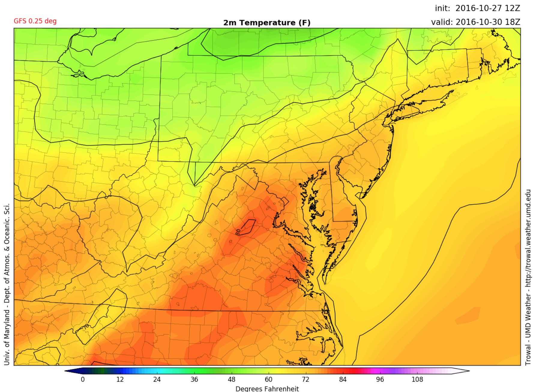
High temperatures in the 70’s projected across the area this weekend (Credit: UMD Trowal)