

Summer continues in the DC area
Forecast Overview
The days may be getting shorter and pumpkins are aplenty, but summer-like conditions have made another return to the forecast area. High pressure has settled off the Mid-Atlantic coast, allowing for unseasonably warm 80-degree temperatures to kick in for mid-October. On Tuesday, daytime temperatures are anticipated to peak near record highs. By mid-week, southerly winds will continue to increase dew points which will supply ample moisture flow and higher humidity levels ahead of an approaching cold frontal system. Given favorable conditions, the cold front is expected to provide increasing cloud coverage and will likely enhance the chances of precipitation before the start of the weekend. Behind the cold front, another ridge of high pressure will build into the region and produce tranquil weather/cooler temperatures for the weekend.
Monday Night
As light winds shift to a calm southerly flow of warm air, we can expect mild temperatures along with patchy fog developing overnight. High pressure off the coast will keep skies mainly clear tonight and temperatures will drop into the low 60s. Wind speeds will range between 5 to 8 mph.
Tuesday
Are any pools still open? We are definitely in favor for another unseasonably warm day as high temperatures peak to the mid-80s (nearly 20 degrees above average). Mostly clear skies combined with plentiful sunshine will allow highs to approach record high temperatures. Light south wind speeds between 5 to 8 mph will increase dew-points to the mid-60s.
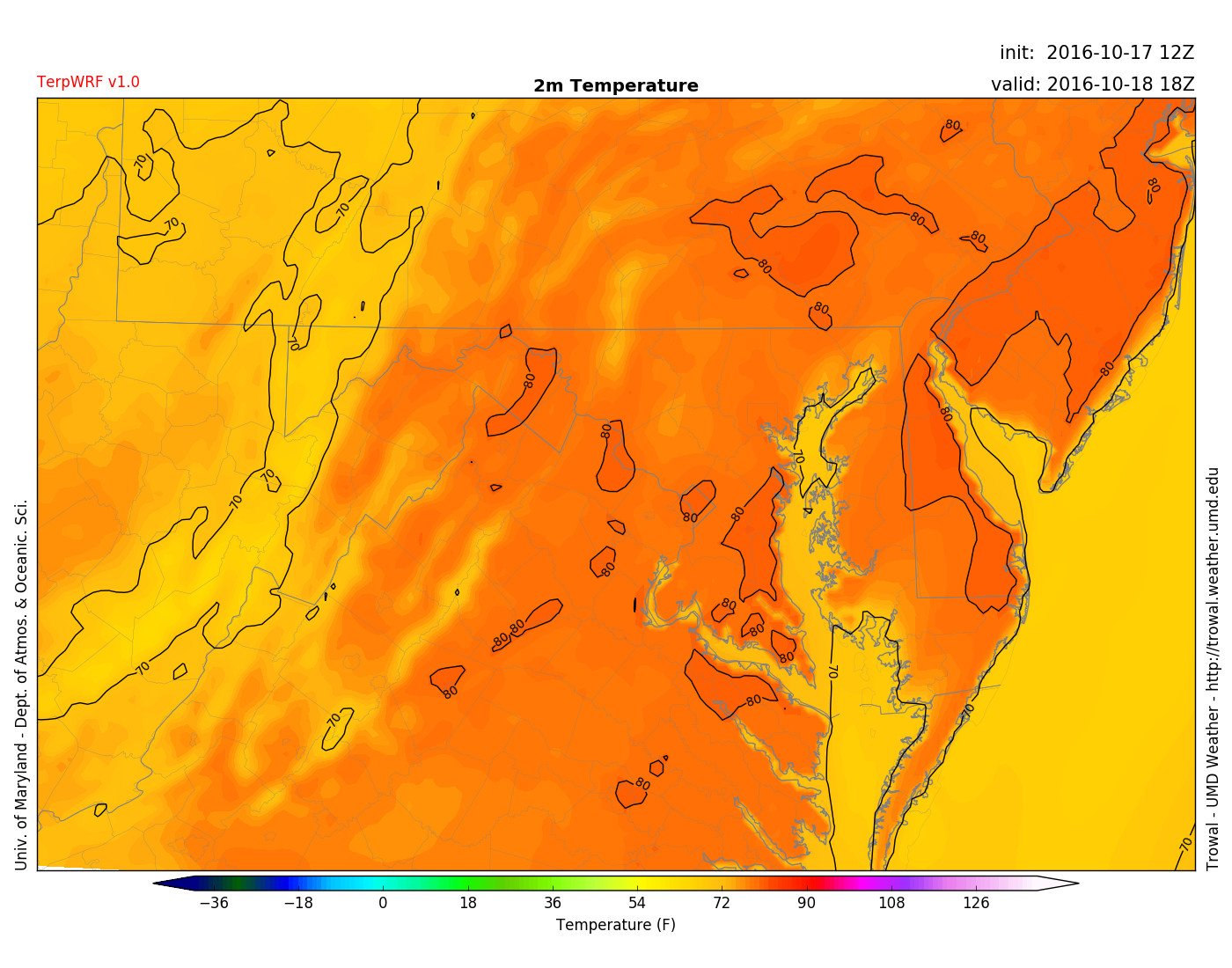
TerpWRF forecast temperatures in the 80s for Tuesday at 2 pm.
Wednesday and Beyond
Wednesday and Thursday will continue to feature above-average temperatures in the mid-80s. By Friday, a cold front which finally makes its way into the region will place high temperatures back into the 60s. A few showers and thunderstorms are possible for Thursday night and Friday afternoon. The weekend will consist of true autumn-like conditions with high temperatures and low temperatures returning to the 60s and 40s, respectively.
Tropical Outlook
Due to Hurricane Matthew and Nicole, the tropics have been very active during the beginning half of October. Currently, ocean waters are fairly quiet with Hurricane Nicole racing north toward cooler waters. However, the National Hurricane Center has identified a disturbance of low pressure near the southeastern region of the Bahamas. The system will remain closely monitored since there is a 60% chance of cyclonic formation throughout the next 5 days.
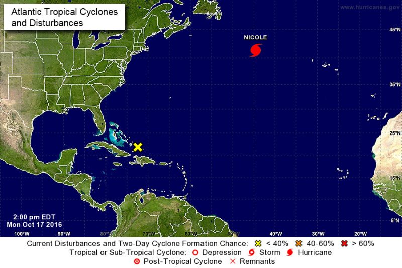
Nicole is still a hurricane, but far away from land. Disturbance in the Bahamas will be monitored. (Photo Credit: National Hurricane Center)