Tracking Hermine
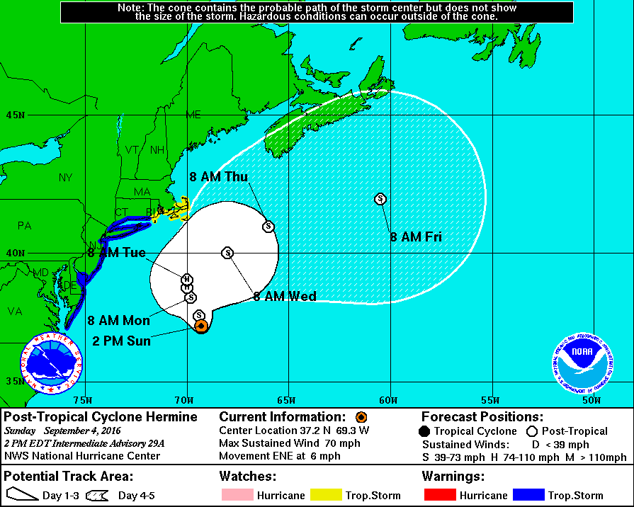
Hermine continues to be a forecaster’s nightmare defying predictions as well as disrupting Labor Day weekend plans. The weather models over the last few days painted a potentially high impact post-tropical storm sitting off the Delmarva Peninsula bringing major coastal flooding and tropical storm winds to the coastal areas. Hermine, however, had another plan in mind moving much further off the coast and defying these predictions. This is good news as the impacts from Hermine will be less than previously thought. The dramatic change in the track has caused the National Hurricane Center (NHC) to discontinue tropical storm warnings for the Chesapeake Bay area. Sunday and Monday will actually feature nice weather for areas away from the immediate coast.

11 AM Forecast Track for Hermine showing it will stay far off the coast. Courtesy of NHC.
Impacts
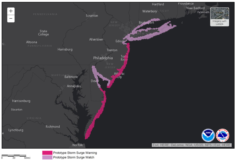
The biggest impact from Hermine will be the moderate coastal flooding that will occur for the Delmarva beaches. Factors that go into storm surge prediction include strength of wind, wind fetch (how long the wind blows over the open ocean), and lastly the direction of the wind compared to the coastline. Hermine moving more off the coast will allow the winds at the coast to be more out of the north instead of the east. This will allow less water to pill up at the coast and reduce the storm surge. Current predictions by the National Weather Service and the National Hurricane Center are calling for moderate flooding at most locations on the Mid-Atlantic and New Jersey coast. This will lead to beach erosion and street flooding in areas typically prone to coastal flooding. However, the impacts are less than originally feared. Large waves and rip currents will make swimming in the ocean dangerous, listen to local lifeguard warnings and do not swim in the ocean without lifeguards present.

Experimental storm surge warnings are currently issued for the coastal areas of Maryland and Delaware. Courtesy of NHC
Hermine moving further off the coast will also help reduce the wind and rainfall potential. Winds at the coast will be blustery at times with gusts over 25 mph overnight Sunday into Monday. For central Maryland and the DC metro area the winds will be lighter at 15-20 mph. Besides a stray shower or two there is low chance of heavy rainfall.
Hermine moving further off shore spared the area of what would have been a high impact storm occurring during Labor Day weekend and will actually help the temperatures stay comfortable for Sunday and Monday before the heat returns next week.
