
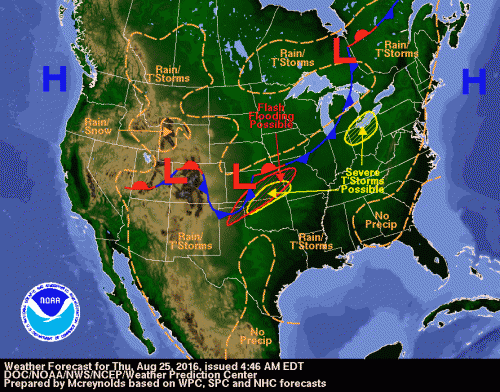
Thursday
High pressure remains over the Atlantic and extends down towards the southern Appalachians. Convection will be dissipating throughout the day but will bring cirrus clouds to the region. This might help keep the temperatures down a little bit but areas still might reach the 90 degrees mark. High dew points tonight will keep the evening temperatures above 70.
Thursdays Forecast: Slight chance of thunderstorms in the afternoon. Mostly cloudy with highs in the upper 80s. South wind 7 to 9 mph. Chance of precipitation 20%
Thursday Night Forecast: Partly cloudy with lows in the lower 70s. South wind 5 to 7 mph
Cold front will approach on Friday
Friday Into the Weekend
A weak cold front will be sliding through the area on Friday with a northwesterly flow behind it. This might have an effect on the temperatures and dew point, but temperatures in the 90s will be common throughout the area. Areas east of the Blue Ridge mountains will see heat indices between 101-105. Once the front passes to the south, high pressure to the north will bring down temperatures slightly and humidity will drop. Although the temperature will still be above average for this time of year.
Friday Forecast: Mostly sunny with highs in the mid 90s. Heat indices may reach 102. Northwest wind 5 to 8 mph
Friday Night Forecast: Clear with lows in the lower 70s. North wind 3 to 6 mph
Saturday Forecast: Sunny with highs in the lower 90s. East wind 3 to 6 mph
Saturday Night Forecast: Clear with lows in the lower 70s