
**Heat Advisory for Majority of DC/Baltimore Area Until 8PM**
Thursday
High pressure will dominate the weather for Thursday. An area of high pressure that has situated itself over the Mid-Atlantic underneath an upper level ridge is pumping in some hot air. This slow moving, sinking air will allow the heat and humidity to build. Highs will be in the mid 90s but with the oppressive humidity the heat index will make it feel closer to 105. These dangerous heat indices required the National Weather Service to issue a heat advisory until 8 PM tonight, which means strenuous outdoor activities should be limited during the peak heating hours. Mostly sunny conditions during the morning will make way to partly cloudy conditions as clouds move in throughout the afternoon. Tonight is the peak of the Perseid meteor shower occurring between 10 PM and dawn. Mostly clear skies and warm overnight temperatures in the mid to upper 70s will make for good viewing conditions. Winds will be light at 5-10 mph out of the southwest.
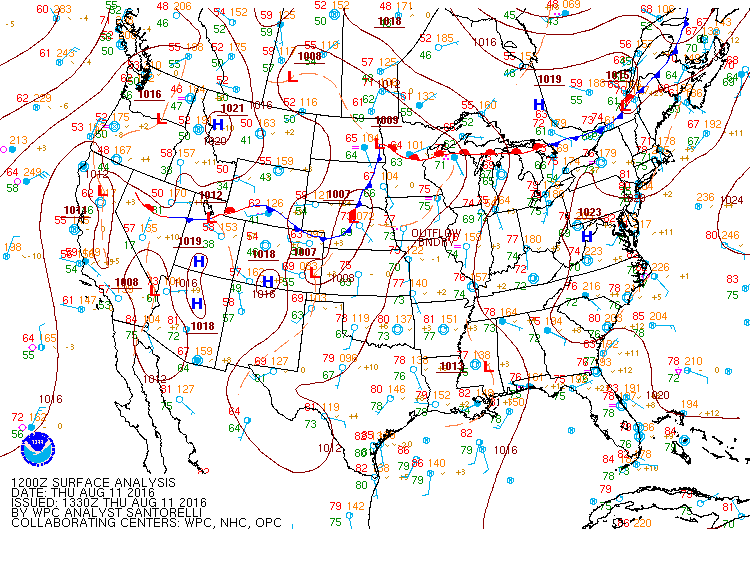
Today’s 12z surface analysis showing the high pressure centered over the Mid-Atlantic. Courtesy of NOAA.
Friday
The high pressure currently centered over of the Mid-Atlantic will not move much by Friday. This will allow the heat and humidity to continue with highs in the mid 90s. Dew points in the mid to upper 70s will make the heat indices again climb to the near or even slightly above 105. Mostly sunny conditions during the day will provide no relief from the heat and outdoor activities should be limited during the afternoon hours. Clear skies will continue into the evening. Overnight lows will be in the upper 70s to near 80 with light winds out of the south at 5-10 mph.
Into the Weekend
The ridge over the East Coast causing the oppressive heat and humidity will continue into the weekend. Saturday could be the hottest day of this extended heat wave with highs in the upper 90s to near 100. On Saturday a disturbance to the north could help spark thunderstorms during the later afternoon. Sunday continue the heat wave with highs in the lower 90s and humid conditions will be present. Afternoon thunderstorms will again be possible as well. Early next week will continue to be the same with highs in the 90s and very humid conditions.
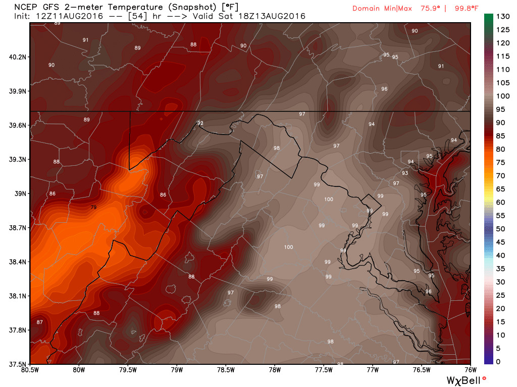
August 11th 12z GFS model run showing the high temperatures in the upper 90s to near 100 for Saturday. Curiosity of WxBell.