** Severe Thunderstorm Watch for Majority of DC/Baltimore Area Until 12AM**
**Flash Flood Watch for Majority of DC/Baltimore Area Until Friday 11AM**
Thursday
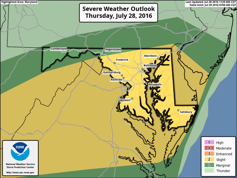
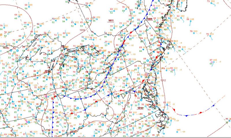
Weak stationary front is stalled out over the Mason-Dixon. Storms will appear as a few discrete cells at first, but then will organize into larger and stronger clusters of showers and thunderstorms. Much of the area is under a marginal or slight risk. Localized wind damage will be a concern. Moist air is converging to the area resulting in the threat of heavy rain in most of Maryland and some of eastern West Virginia (North of I-66/US-50). It is unclear at this moment how late into the night this will last. This evening will have showers and thunderstorms with the potential for heavy rain and gusty winds. Lows will be in the mid-upper 70s. Calm east winds at about 5 mph. Chance of precipitation 80%. Rainfall amounts can reach three-quarters of an inch in some areas.


Stalled out frontal boundary over the mid-Atlantic
Friday
The low pressure in our area will be shifting to the east by the afternoon. As this low pressure moves, expect a possibility of rainfall during the morning hours. The potential for rain may linger into the afternoon hours. The stability of the airmass will depend on how quickly the front moves across the area. If the low pressure and front moves out slowly there is a slight chance for thunderstorms in the middle of the day. During the day Friday the chance of showers and thunderstorms is likely before 11AM with a chance remaining into the afternoon. Mostly cloudy, with highs in the mid-80s. West winds around 9 mph. Chance of precipitation 70%. Friday night also has a slight chance of showers and thunderstorms and will remain mostly cloudy. Lows in the lower 70s. North winds around 5 mph. Chance of Precipitation 20%
Into the Weekend
Showers and thunderstorms may develop Saturday afternoon into the night, bringing heavy rainfall. On Sunday, the stationary front that’s been hovering in our area may get a push south from a low pressure, with a chance for showers as this occurs. Finally a high pressure over new England will push drier air down towards the Mid-Atlantic
