** Severe Thunderstorm Watch for entire DC/Baltimore area until 10 PM**
Monday Evening
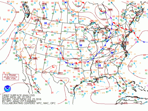
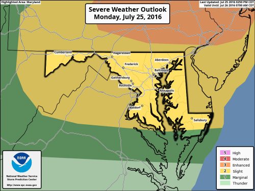
High moisture content will allow heat indices to range from 105-109 across the region dissipating slowly into the evening, causing a warm humid night. A cold front will be approaching overnight from the northwest bringing a possibility for scattered strong thunderstorms. These organized thunderstorms would occur along and north of U.S. Highway 50, and would be occurring mainly before 2 AM. The main threats associated with these storms include damaging winds and potential localized flooding. Tonight will be mostly cloudy with a low around 77. Winds coming from the west at 5-8 mph, becoming light and variable after midnight. Chance of precipitation at 50%

Cold front approaches mid-Atlantic tonight

SPC highlights enhanced risk for severe weather tonight
Tuesday
The passing cold front will stall south of the DC region into Virginia by the morning, bringing light northerly winds. Although these winds will bring some slight relief to the heat and humidity, temperatures will still reach the mid 90s with heat indices near or above 100 degrees. A threat of showers and thunderstorms remains into Tuesday afternoon and evening. A marginal risk of severe weather has been introduced. With the front stalled into Wednesday, the pattern will not change much. Tuesday night will be mostly cloudy with lows around 74. Winds coming from the southwest at about 5 mph diminishing into the night. Chance of showers and thunderstorms remains into the night. Chance of precipitation 30%.
Wednesday and Beyond
The front may become stalled out over the region, remaining here into Wednesday/Wednesday night. Showers and thunderstorms can not be ruled out throughout the day.A general northwest flow aloft will keep heat and humidity down, but temperatures will remain above normal for this time of year. The threat for thunderstorms remains into the end of the week with the front still stalled out nearby. Some storms could be severe with heavy rain and gusty winds becoming the main possible threat.
