In the wake of last night’s surprise thunderstorms, conditions will be pleasant and near average for the next two days. For those who were up or woken up from the near constant thunder late last night witnessed one of the most intense thunderstorms to hit the DC metro area in recent years. Golf ball sized hail, blinding rain, and brilliant lightning were all seen throughout our area and led to flash flooding, tree damage and power outages. The same cold front that was responsible for the damaging thunderstorms also helped usher in cooler and less humid conditions for Wednesday and Thursday. However, the heat and humidity will begin to return on Friday and will continue though the weekend as the heat dome currently over the Mid-West moves into the Mid-Atlantic region.
Wednesday
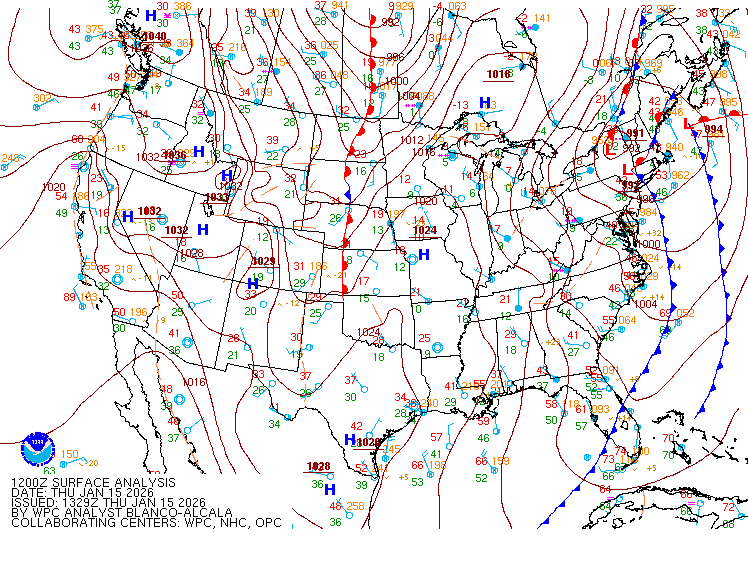
Today will be the most comfortable day of the week with low humidity and dry conditions. An area of high pressure is currently to our north, which will bring abundant sunshine and light winds during the day.

Courtesy of NOAA: The current surface analysis for Wednesday July 20, 2016. Shows the cold front to the south and the area of high pressure to the north bringing sun and mild conditions to our area.
With a slightly cooler air mass behind the cold front, highs will only be in the mid 80s and with the low humidity making today feel spectacular. The high pressure will continue to dominate our weather tonight and will bring dry conditions this evening. Tonight’s lows will be in the low 60s in the suburbs and mid 60s in the metro area.
Thursday
The high pressure will begin to move off the coast Thursday allowing warmer air to begin to move in the area. The winds will start to come out of the south during the day, which will help bring warmer temperatures than Wednesday and more humid air. Conditions during the day will be mostly sunny but there could be a few clouds during the evening. High temperatures will be in the upper 80s to near 90 with humidity building during the day. Overnight low temperatures will in the lower 70s.
Friday and Into The Weekend
Starting Friday some of the hottest conditions of the summer will begin over the Mid-Atlantic. In response to the upper level tough currently over the Eastern United States moving out into the Atlantic Ocean a ridge will begin develop over the Southeast and Mid-Atlantic regions. The heat and humidity will begin to build underneath the ridge. A heat wave is expected in the DC metro area as temperatures will be above 90 for more than 3 days in a row starting Friday and lasting into early next week. Both Saturday and Sunday have a chance for temperatures to flirt with 100 degrees especially south and west of the metro area, with the National Weather Service calling for the upper 90s both days. Regardless if temperatures reach 100, the high humidity will make for dangerous conditions with heat indices in the 100-105 during the weekend and into next week.

The National Weather Service’s high temperature prediction for Sunday July 20th. Shows widespread upper 90s for the DC metro area. Courtesy of Wxbell.
