
Marylanders are familiar with wacky, indecisive weather, especially in the spring. This week will be no different.
On Saturday, there will be a return back to winter temperatures and snow in the forecast. But let’s tone the word “snow” down a bit. Yes, Maryland is going to be above the “540 line”. The figure below depicts the forecasted thickness for mid-Saturday morning. The 540 line (meaning 5400 meters) is the general rule-of-thumb when deciding if precipitation in a certain area is going to be rain (below 540) or snow (above 540). The lower atmosphere will be very cold and cold air is more dense than warm air, hence why the atmosphere is thin.
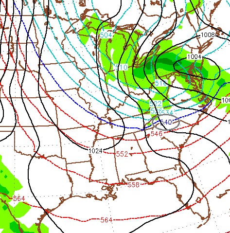
06Z GFS MSLP, Precip, and 1000-500 MB Thickness at hour 30 (5400-m line circled in gray)
However, the temperatures at the surface will most likely be above freezing, so don’t expect much snow to stick to the ground. At most we will get trace snow accumulation in the morning and precipitation will turn back to rain by afternoon. The figure below shows the National Weather Service snow accumulation potential forecast. In addition to the frozen mix, expect blustery conditions. There will be sustained winds around 20 mph, and 40+ mph gusts! High gets up to 46 degrees, low 28.
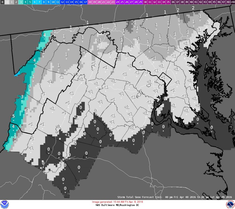
Snow Accumulation Potential up until Apr 9 at 8am
Sunday looks much better. There will be plenty of sun and calm winds. There will be a chill in the air with a high around 50 degrees, low 39.
April showers come back for the beginning of our week. Monday’s weather will be partly cloudy, but there is a chance of rain. High in the upper 60s. Rain is likely on Tuesday for most of the day, with highs in the lower 60s. Wednesday and the end of the week will be drier and more pleasant. It will be mostly sunny with highs in the upper 50s.
Cross your fingers that the trends for next weekend show some springlike warmth!