
Chance of UMD School Cancelation: 0%
Chance of a UMD 2 Hour Delay: 10%
Light snow has quickly spread across the DMV this evening. Think of it as Winter’s last hurrah. While the light dusting of snowfall will most assuredly make for some pleasant morning scenery, little to no negative commute impacts are expected in both the DC and Baltimore areas.
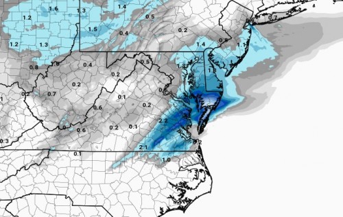
HRRR Total Snowfall at 7am on March 4th
The image above is a high-resolution model expectancy for total snowfall in the area by 7am tomorrow morning. Extreme south-eastern Virginia as well as much of Delaware will make out the best as far as snowfall totals go. A strengthening low pressure off the North Carolina coast will develop too far south for our area, but figures to bring the aforementioned areas a good 2-4 inches of the white stuff.
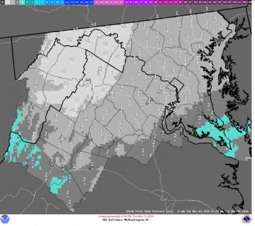
NWS Sterling snowfall forecast
This is the latest area wide snowfall forecast from the NWS Sterling office. Although, we here are UMD weather are starting to think that even this snowfall expectancy map might be a little overzealous. Latest guidance suggests a pretty large area of dry air will intrude overhead tonight, effectively cutting off what little snow has been falling.
As far as delays and cancellations go, we expect hardly any in the DC/Baltimore area. A much greater chance for delays and cancellations in the areas that are expected to see over 2 inches. In any case, get ready for a nice warm up over the next 2 weeks. The Climate Prediction Center is forecasting a warm mid March for the entire eastern half of the country. Hopefully by this time next week, we are talking about some 70 degree days!
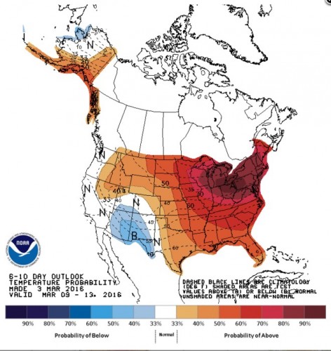
Climate Prediction Center 6-10 day temperature probability outlook