Active weather day on tap for the DC/Baltimore area. Despite the calendar reading February 24th, much of the region should experience our first rumbles of thunder of 2016. There is also the possibility of some borderline severe thunderstorms in isolated areas with gusty winds, frequent lightning and heavy rain.
Overview
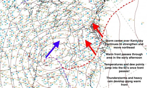
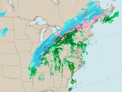
A strong late winter storm resulted in some severe weather and tornadoes yesterday in New Orleans and along the Gulf Coast. This dynamic system continues to strengthen bringing heavy snowfall to Chicago and parts of the upper Midwest on the cold side of the storm and heavy rain and thunderstorms elsewhere. We are in the latter group.
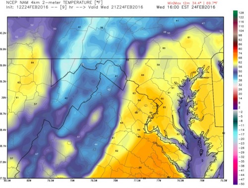
Early in the afternoon, a warm front associated with the storm center will push through the region. Temperatures and dew points will rise dramatically in a matter of minutes. DC and Baltimore should see temps in the mid 60’s with dew point temperatures in the low 60’s. Readings more reminiscent of summer rather than late February.

Surface map for February 24th
Once the warm front moves through, our air will be ripe with moisture. The combination of high moisture content, a strong frontal boundary and cold air overhead (associated with the strong low pressure to our west) creates some ripe conditions for heavy rain and thunderstorms.

Modeled temperatures at 4pm this afternoon
Let’s pause for a brief meteorology lesson! We know that air cools as it rises. This typically happens at a constant rate, called the lapse rate. However, air that has an excessive amount of water in it (like this afternoon’s air mass will) actually cools SLOWER than drier air. Why is this important? Because of something we call stability. In order to get thunderstorms, you need air to rise quickly and to very high altitude. Air that is filled with water gets pushed upwards by the warm front and cools SLOWER than the air that is already just hanging out in the upper atmosphere. Still with me? The moist air that was pushed upwards from the surface is now WARMER than the surrounding air at higher levels. This creates instability, which means that the warm moist air bubble will continue to rise (think of big thunder clouds) and create large thunderstorms.
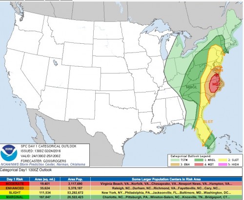
Ok. No more lessons I promise! The Storm Prediction Center (SPC) has placed our area under an “enhanced” risk of severe thunderstorms this afternoon in response to the favorable setup.
Timeframe
Now-2PM: Light rain showers with some heavier downpours possible
2PM-8PM: Heavier rain and isolated thunderstorms. Greatest risk during this period for severe thunderstorms. Biggest threat likely to be heavy rainfall which may cause some localized flooding.
Stick with us on Facebook and Twitter for more updates throughout the day.


