As of 3:30pm this afternoon, moderate snowfall has overspread the entire DMV area. What’s perhaps a little surprising to some is that this snow we are experiencing this afternoon is not even originating from what will eventually become our main storm system. Let’s get a little technical:

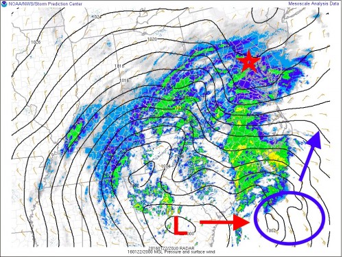
Surface pressure and radar along East Coast at 3pm on 1/22/16
Pictured above is the surface pressure distribution and radar around the mid-Atlantic from this afternoon. Notice the large L denotes the current 1002mb (millibar) storm center currently responsible for our afternoon snowfall. Over the next few hours, energy will be “handed off” to a secondary low pressure system that will develop just off the coast of South Carolina in the area depicted by the blue circle. This is where our monster storm will start to take shape! Infused with tropical moisture and being energized by warm ocean water, this secondary low will intensify rather quickly as it slowly lifts to the northeast.

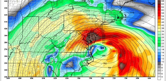
Surface Pressure and Wind forecast for 8am on 1/23/16

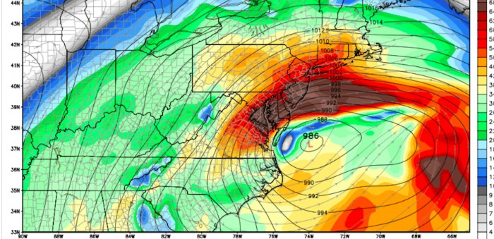
Surface Pressure and Wind forecast for 2pm on 1/23/16
The images above are taken from the Global Forecast System (GFS) model, showing the forecasted low pressure position and surface winds at 8am and 2pm on Saturday. A couple of things to note here. First, notice the rapid intensification this new storm center has undergone, dropping to 987mb. Those tight lines indicate a very sharp pressure gradient which will result in very strong winds. Additionally, notice how little the storm center moves over a 6 hour period, virtually “stalling out” just as it begins to reach its peak intensity.
Not surprisingly, this time period from about 8am-2pm on Saturday is when DC and Baltimore will experience the worst conditions.

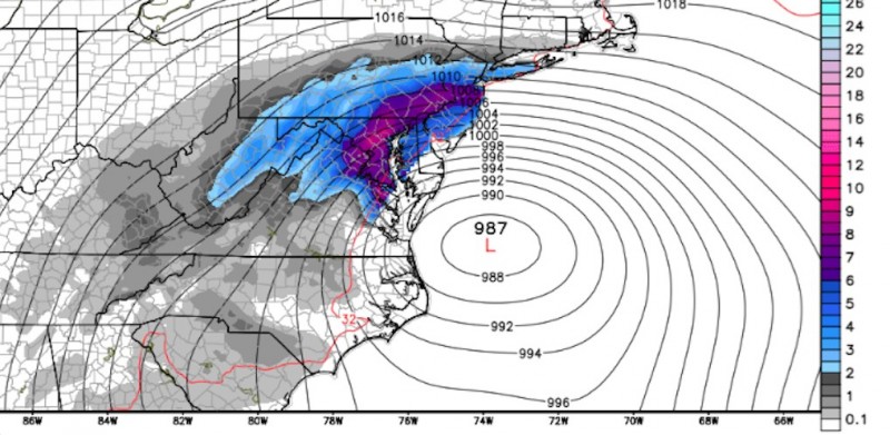
6 hour snowfall accumulation for 8am on 1/23/16
The above map is also taken from the GFS model and shows the forecasted 6 hour snowfall rate as of 8am tomorrow morning. This map only includes the amount of snow expected to fall in the 6 hour period from 2am-8am. Much of the DC/Baltimore area will see upwards of 6 inches of snow during this time alone! Extrapolate similar snowfall rates over the next 6-10 hours (just as the storm strengthens and stalls) and you can begin to get an idea as to why many forecasting outlets (us included) are predicting close to 2 feet by the end of the storm.
