
In today’s weather discussion we started off by looking at current surface and upper air maps. We looked at multiple levels of the atmosphere and observed how the wavelength of the ridges and troughs has shortened and that the ridiculously resistant ridge over the Western United States for much of the winter has been replaced with a trough. On the 300mb map we talked about how there was a jet streak currently over Idaho that would help fuel severe thunderstorms in the Missouri and Arkansas region on Wednesday.
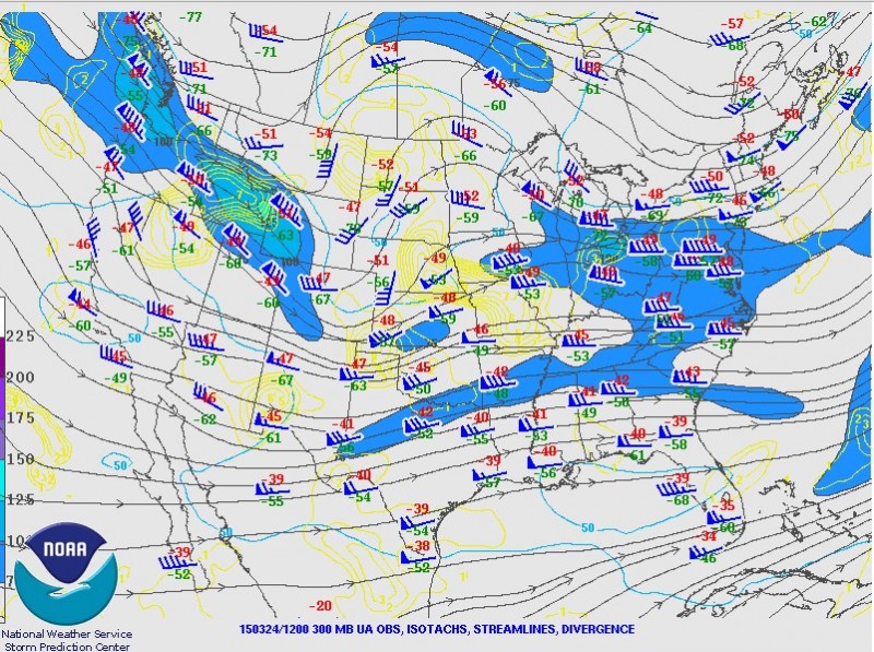
12z 300mb SPC Upper Air Map
March is typically an active month for severe weather, however, this month has been the quietest since at least 1950. The Severe Weather Prediction (SPC) usually issues multiple tornado watches during the month of March, but so far there has not been none. This makes it the first time the SPC has not issued a tornado watch for the whole month of March up until today. The number of tornadoes reported so far this year are also very well below normal, but looking at the models severe weather is possible this week.
Looking at the 12z NAM we talked about variables that are taken into account when discussing the possiblity of severe weather. Convective available potential energy (C.A.P.E) is a measurement used to gauge how unstable the is atmosphere; more CAPE allows for more vertical motion and possibly stronger thunderstorms. We also looked at helicity, which is the low level spin in the atmosphere, and is good to look at when trying to predict if tornadoes could form. According to the 12z NAM the Wednesday had more potential for severe weather, with higher CAPE and helicity, than Tuesday, but both days damaging winds and hail are possible in the Mid-West.

12z NAM for Wxbell
Finally, we looked at the 12z GFS to see if our area had potential for thunderstorm storms before the cold front passage on Thursday. The GFS predicted moderate instability in the area and with surface temperatures reaching the upper 60’s and possibly in the 70’s with high dew points. This suggests that there is at least a possibility for thunderstorms in our region during Thrusday evening. which is just another sign that spring is slowly arriving.